The weather wizards were right.
On Wednesday morning, Juneauites woke up to find that the National Weather Service winter storm warning had held true: Snow covered the capital city, and more continued falling throughout the day.
“We have just around 10 inches of snowfall since the start of snowfall yesterday morning,” forecaster Richard Lam said at 10 a.m. Wednesday from the Mendenhall Valley, where the Weather Service offices are located.
By 3 p.m., the total at the office had increased to 12.1 inches.
At Juneau International Airport, the city’s official measuring site, the total for Tuesday was 3.3 inches and another 9.8 inches was recorded by 3 p.m. Wednesday, setting a record for that date. The old record, 9.6 inches, was set Nov. 18, 1966.
Wednesday goes into the books as the 11th snowiest November day in Juneau since 1943, when accurate record-keeping began. This much snow hasn’t fallen at the airport in a single day since Nov. 21, 2013, when 10 inches was reported there.
A final snowfall total for Wednesday was expected at midnight, after the Empire’s press deadline, but the snow began to slacken in the afternoon, and little extra accumulation was expected. The Weather Service allowed its winter storm warning to expire at 4 p.m.
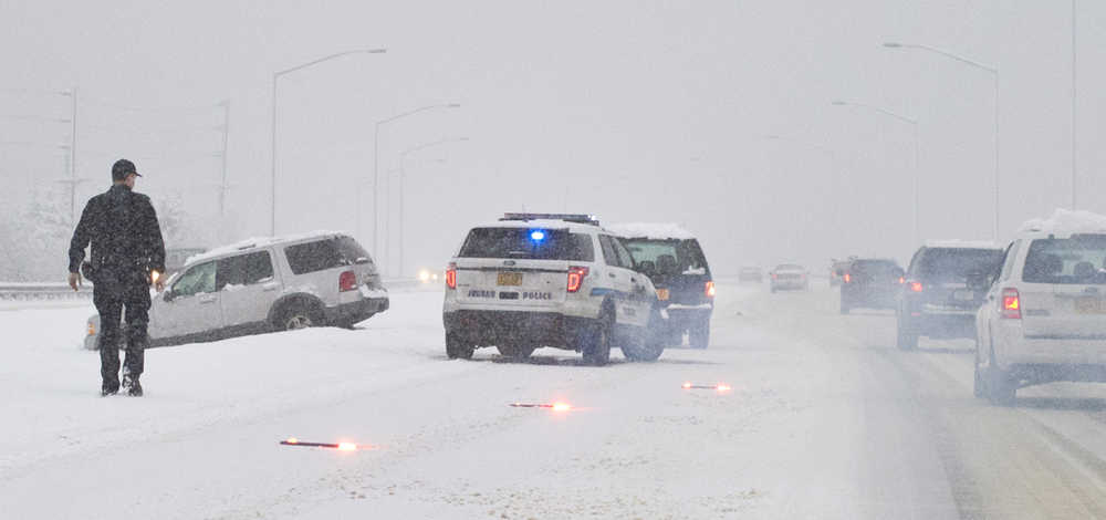
On Tuesday evening, roads rapidly slickened after sunset, leading to a treacherous commute home for many drivers. Between 6 a.m. Tuesday and noon Wednesday, the Juneau Police Department received 19 reports of motor vehicle crashes involving damage and 14 reports of vehicles that slid into roadside drainage ditches, Lt. David Campbell said.
“That’s quite a bit,” he said.
No injuries were reported, but police were forced to direct traffic off Egan Drive and onto Glacier Highway at least once due to an accident that blocked the outbound lanes.
On Wednesday, drivers appeared to be more prepared for the conditions. “So far, it’s pretty mellow,” said Capital City Fire/Rescue Chief Richard Etheridge.
Jeremy Woodrow, a spokesman for the Alaska Department of Transportation, said plow drivers were spraying a brine mixture onto state-owned highways. The mixture raises the freezing point of water on area roads, keeping it from solidifying into ice.
“Last night’s commuters probably noticed Egan was a little bit slippery, so we’ve been trying to get out ahead of it,” he said.
At Juneau International Airport, manager Patricia deLaBruere said plow drivers were able to keep ahead of the snow, and flights still arrived. “We’re fine,” she said.
Alaska Airlines flights did not appear to be delayed on Wednesday, and Delta Airlines flights arrived in the morning after failing to arrive Tuesday night.
The City and Borough of Juneau Docks and Harbors Department said no boats have sunk due to snow accumulation, but it is advising boat owners to remove snow as soon as possible and to re-check bilge pumps and mooring lines.
Eaglecrest Ski Area did not post updated snow totals Wednesday, and no one answered phones at the Eaglecrest offices, but the Weather Service reported 7.5 inches of new snow at the ski area’s base by 8 a.m. Wednesday.
Elsewhere, downtown Juneau and Auke Bay each reported 5 inches of snow by 8 a.m. Wednesday. Updated totals for all three locations are expected this morning.
More snow is expected today: The Weather Service has issued a winter weather advisory calling for 3-5 inches of fresh snow between 6 a.m. and 6 p.m.
Woodrow said state plow drivers are working two shifts and will be on call to remove snow as needed.
Forecasters are calling for conditions to change rapidly by the evening as winds shift from the northwest to the southwest, bringing warmer air into the area.
By Friday, temperatures should be in the upper 30s or low 40s, and heavy rain is expected. That rain is expected to continue through Saturday night, when colder air returns to the region and snow becomes possible again.
The return of cold weather is expected to bring icy conditions if this week’s snowpack survives the meltdown on Friday and Saturday.

