
KENAI — How would an inspection of a 200-foot tower only accessible via Kenai Lake normally be done?
A surveyor could row, row, row a boat, climb up the scaffolding, and possibly spend hours determining its condition, but K2 Dronotics LLC, doesn’t want to do things traditionally. The start-up prefers “getting to places where others can’t” by flying to hard-to-reach areas and safely surveying via drones, in a fraction of the time.
Founded by siblings Ben and Nick Kellie — experienced engineers and certified drone operators — the Anchorage-based company offers aerial data collection in regions across the state. Having grown up as Bush pilots, the Kellie brothers are combining decades of home-grown knowledge of Alaska’s remote, rural areas with their analytical minds, while applying existing technology to turn raw data into 3D mesh.
“Anyone can fly a drone,” said Ben Kellie, in an interview held at The Boardroom in downtown Anchorage. “We know more of what we’re looking at.”
K2 Dronotics, named for a play on words, recently celebrated its first anniversary. While the initial six months were spent applying and waiting for FAA approval, the Kellie brothers nevertheless had a great debut year, building a client base before the expected onslaught of competition. Much time was also spent educating local businesses on the positive impact of this new and sometimes scary technology.
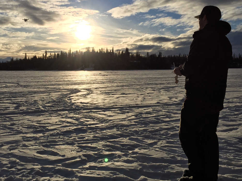
“Drones aren’t a bad and scary thing. They are actually extremely useful up here for almost every industry,” said Kellie.
How to drone on and on
Totally bootstrapped, the start-up’s founders — both University of Alaska Fairbanks alumni — market themselves through frequent demos and “lunch and learns.”
“A lot of the things we’re looking at is, how can we help identify resources in rural Alaska?” asked Ben Kellie. “How can we help maintain infrastructure and do these jobs in places where you usually have to drag in a lot of people and equipment and it’s expensive?”
Here’s how it works:
Nick Kellie plans a detailed modular grid of the site in question. Workarounds can be created on the fly to accommodate obstacles and height restrictions, as drones may not exceed 400 feet above ground level according to FAA regulations. Doubling as a spotter, he will keep an eye out for air traffic and passerby, because unmanned small aircraft must yield to other aircraft, and cannot fly above anyone not participating in the operation.
Ben Kellie is the pilot in command, operating a Phantom Professional model with 4K camera, manufactured by DJI but modified by the brothers for rugged and cold terrains. (The siblings are also working on making adjustments for wet weather.) The addition of polarized filters especially helps on snow-blinding days or when a drone is needed for fish spotting under water.
Drones are transported in Pelican cases featuring custom-cut foam to keep the drone and tools secure. Cases are labeled with nicknames such as the Drone Wolf and Drone Ranger. Because battery life is limited, spares are brought along for multiple passes over the area to be surveyed. Photos are full-color and fully realistic, as opposed to basic blips.
Several hundred photos may be taken per site, depending on the job. Data is then entered into GIS software, where information can be transformed into fully measurable and maneuverable 3-D maps. When a client wants to know where to place equipment to offload from a barge, for example, the distance between the center of the barge and the center of the crane can be determined and the client can act accordingly.
Real world meets
virtual world
Bristol Bay Native Corp. required a survey of the King Salmon gravel pit, as the 75 acres had not been surveyed in a while. BBNC, which has subsurface rights, needed to calculate how much volume has been extracted over the last couple of years. Historically there have been issues with determining quantities sold with what has been paid.
Previous cross-sectional surveys were conducted manually — meaning someone would literally have to walk around. Even with the GPS method, it’s definitely more than a day’s work, said Mischa Ellanna, a geologist/GIS analyst with the BBNC.
In contrast, “K2 did it in the morning, and then we went to lunch,” he said.
Two key pieces of data came out of the survey: the topographic surface rendered in a 3D model, and orthophotography.
“The resolution was amazing,” Ellanna said. “A surveyor can give us the topography surface, but they do not have a plane or anything up in the sky taking pictures.”
He noted that topography allows for contour intervals and volume calculations. Orthophotography, however, can also discern trees from tundra, gravel and stock pile locations and what equipment is currently on site.
“The biggest aid is knowing the true extent of the gravel pit which can’t always be determined from the surface,” he said.
BBNC has two likely projects in the works with K2 Dronotics.
The future of drones
Until recently, the sale of drones has largely been driven by recreational users. The enterprise market is still in early adoption phase, with media/entertainment leading the pack along with agriculture, real estate and retail outlets interested in alternative delivery systems.
However, according to a report recently issued by Hexa Research, the global commercial drone market is projected to exceed $2 billion by 2022, up from $552 million in 2014. North America accounted for a majority share, and is projected to regionally dominate in the future, with significant growth also expected in China, India, Japan as well as U.K., Germany, France and Russia.
Going forward, the U.S. may likely be helped in this regard by the FAA’s small Unmanned Aircraft Systems, or UAS, rule. In effect as of Aug. 29, the new regulation is designed to streamline the drone pilot approval process. As of now, however, the FAA is experiencing high volume and thus, delays in awarding certifications. To date, 5,552 authorizations have been granted for commercial operation. Less than 50 have been granted in Alaska.
“It’s not just a flight of fancy but a serious deal,” said Ben Kellie. His brother, who is more interested in creating comprehensive site plans than corporate communications, silently nodded in agreement.
• Stephanie Prokop is a reporter for the Alaska Journal of Commerce, and she can be reached at stephanie.prokop@alaskajournal.com.
