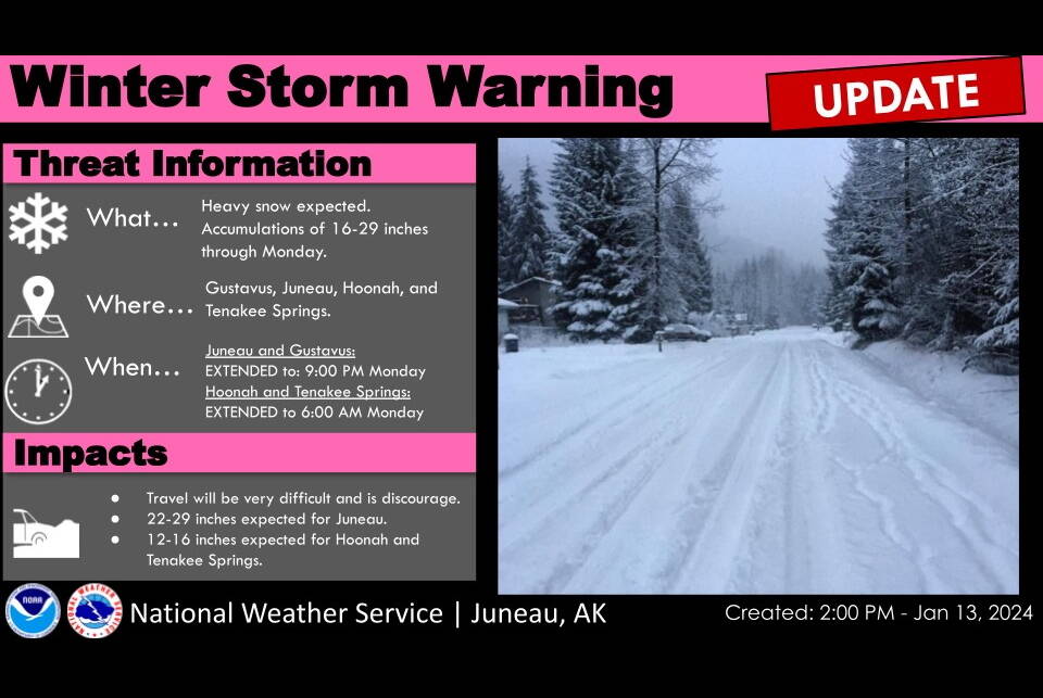
A storm is expected to dump 22 to 29 inches of snow on Juneau by Monday evening, due to unusual accumulation from multiple arriving weather systems, according to a National Weather Service Juneau forecast issued Saturday afternoon.
The risk of avalanches will also be high and “nearing extreme” by Monday as increasingly wet, heavy snow layers on top of the light-density accumulation Saturday, according to Tom Mattice, emergency programs manager for the City and Borough of Juneau.
Some parts of Juneau have already received as much as 13 inches of snow as of 3:30 p.m. Saturday, although accumulation varies considerably by area, said Greg Spann, a meteorologist for NWS Juneau. While a storm warning on Saturday morning forecast heavy snow until 6 a.m. Sunday, the warning was extended during the afternoon to 9 p.m. Monday.
One factor in the heavy accumulation was a cold snap — with temperatures dropping as low as two degrees on Friday — just before the snow arrived.
“We have multiple systems showing up,” Spann said. “Not all of them are necessarily all that strong. But what they all have in common is they’re all moving into this pre-existing air mass, that cold air that we had from the most recent outflow event. And so as a result we’ve seen some fantastic snow ratios.”
He said snow ratios of 40-to-1 and above have been measured, meaning one inch of precipitation resulting in 40 inches of snow accumulation, “which are uncommon, to say the least.” That means the snowfall so far is light in density, but that is expected to change as temperatures warm and make the snow’s water content higher on Sunday.
“There will be some occasional relative lulls with the snow to some degree between these waves of systems as they go through,” Spann said. “But once again we are expecting these systems to keep on coming by, so we’re just going to see round after round of snow.”
A warning about avalanches by was issued on Facebook early Saturday evening by Mattice, stating the risk level is going “from considerable to high tonight and nearing extreme by Monday.” The concern, he said, is the snow layers resulting from an “upside down” storm.
“All this snow is coming in on a shallow snowpack with multiple faceted layers and wind slab on top,” he wrote. The result is that in addition to a high risk of avalanches “these slides will be large and fast traveling long distances.”
Many other Southeast communities are seeing similar weather — although, as within Juneau, accumulation totals vary widely — with Pelican the hardest hit as of mid-afternoon with more than 13 inches of snow, Spann said.
The forecast for Juneau on Tuesday — the first day of the legislative session — and the days beyond call for drying conditions, he said.
• Contact Mark Sabbatini at mark.sabbatini@juneauempire.com or (907) 957-2306.

