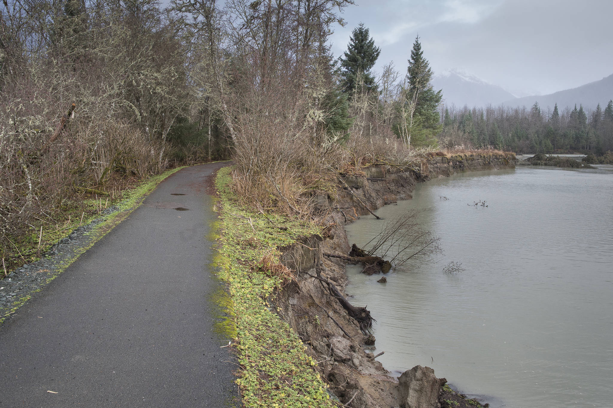
This is Rain Country, so it is no surprise that our trails often erode. On sloping hillsides, water seeks the easy way down, and we often help that happen. Repeated tramping of feet (and bikes) can turn a trail into a rain gutter, or sometimes a stretch of gutter alternating with puddles and pools. We splodge up and down in the gutters making them worse, and we often walk around the edges of the pools, making them bigger and worse.
To some extent, erosion due to normal trail use is inevitable. It takes considerable amounts of money, effort and interest to keep up with the wear and tear. I’ve seen several places where a start has been made on fixing these spots of relatively minor erosion. For instance, a major mudhole on the Auke Nu trail has a short detour of new trail. Placing log rails and cross-pieces (making “boxes”) for containing gravel for a new tread over a soggy stretch can be very useful, as long as the gravel deposits fill the boxes really well. However, too often the incompletely unfilled boxes just make a trap for water — and walkers sometimes just avoid them altogether, making new trenches.
But all of that is small potatoes compared to what Mother Nature is ineluctably doing. Our vigorous mountain streams can tear out many yards of trail. I’ll mention just a few examples: Near the end of Perseverance Trail, Gold Creek ate away the trail, necessitating an informal detour to get around the vacancy. On the long traverse where the Sheep Creek Trail goes from the top of the initial rise to the main valley, small rivulets have deeply gullied their way across the trail in several places and the edge of the trail has been eaten away in places, so that walking there is a parlous endeavor. A much larger trail disappearance is found where the Lemon Creek Trail made a sharp turn to follow the creek up the canyon toward Camp 17. The entire corner seems to have disappeared, thanks to the big creek itself, making it unclear how to access the canyon. Parks and Rec used to do this hike regularly (before the washout), and I have encouraged current P&R hikers to scout out a good way to reach the trail up the canyon.
We know water runs downhill, so erosion on the slopes is not unexpected. But it comes as a surprise, at least to some folks, when rivers coursing over flatter ground accomplish major erosion. Geologists and hydrologists, for example, know well that flatland streams tend to meander, changing their courses — down-cutting on one reach for a while, but then moving over to cut a new route. Some of the folks who built houses along the Mendenhall River probably knew this, but others no doubt thought the river would stay put.
Local observers have enjoyed watching the gradual breakthrough of the former gooseneck peninsula on the lower Mendenhall, leaving a small island separated from the mainland on the west side by a wide swath of open water. Below the breakthrough, most of the flow currently goes down the east side, by the housing project, but erosion along the west side of the first part of the paved Brotherhood Bridge Trail is sufficiently serious that CBH has closed that segment of trail and even torn up some of the blacktop there. CBJ recommends that walkers use the alternative trailhead on nearby Wild Meadow Lane.
Farther up the valley, a side trail passes from the Brotherhood Bridge trail along Montana Creek to the Back Loop. Just above the bridge over Montana Creek, several large trees have had their underpinnings cut out from under them, so they have fallen across the creek, where they met a few more washout victims from the other side of the creek. The trail is gone, where this happened, and a short informal detour is developing.
The walk on the Boy Scout trail out from the forest to the first meadow now skirts some badly undercut banks of Eagle River. The trail has been moved in-board a little way. Out near the point, the grove of big trees is being whittled away, as root systems are greatly undermined by the river; trees on the edge of the grove are likely to fall soon. Out along the beach, where the river meets the tides, chunks of root-bound sand are falling regularly, widening the upper beach and shrinking the grass-clad berm.
It’s a never-ending task, keeping our trails in good shape. Some trails, such as the one to Cowee Meadows, have been furbished up very nicely. The Granite Creek Trail has been much improved, with more work intended. The Treadwell Ditch trail has been a work in progress for several years, replacing three major lost bridges, adding some gravel and a major detour (with bridge), but lots more work is still needed, before one can walk easily from Eaglecrest to Douglas. Juneau has the potential for a world-class trail system, but the potential will only be realized if public interest is kept up and funding is improved.
• Mary F. Willson is a retired professor of ecology. Her essays can be found online at www.onthetrailsjuneau.wordpress.com

