SAGANAVIRKTOK RIVER
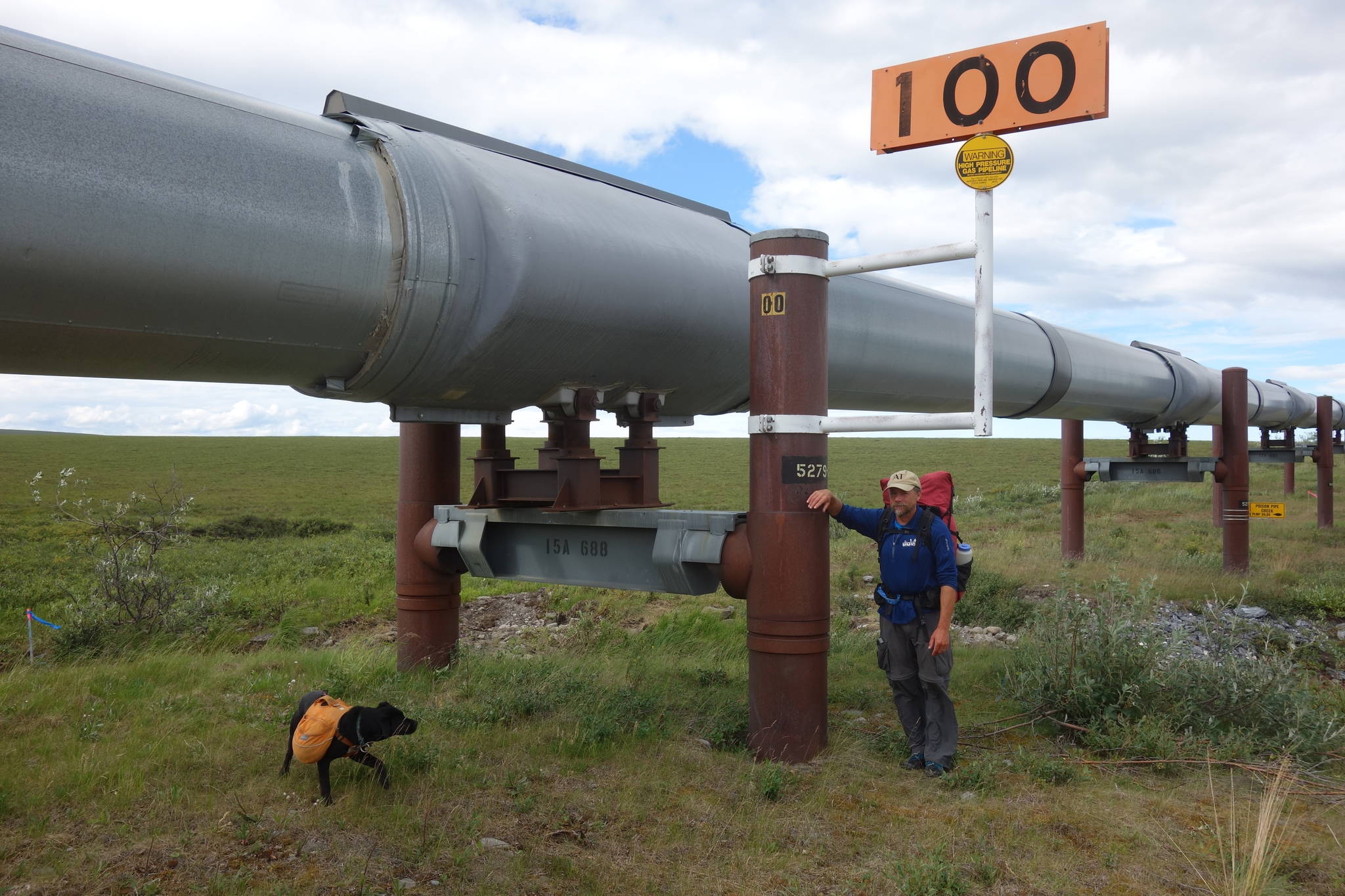
And we just passed Trans-Alaska Pipeline mile 100, which means that distance remains on our summer hike from Valdez to Prudhoe Bay. My dog Cora and I started walking on April 30, which means we’re in our fifth month of sleeping outside.
For this week, I’m hiking with Eric Troyer, who ran the White Mountains 100 race in less than two days this spring. I did the same thing a year before. I guess that means we can wrap this journey up by the weekend.
Not really. We’ve been walking about 10 miles each day. So, about 10 more days should do ‘er.
There are incentives to finish. Like when the wind dies, and the North Slope mosquitoes swarm and the gnats kamikaze your eyes and mouth. We were not late enough for the first freezes of arctic fall to thin out the herd. Instead, we’ve had days reaching 60 degrees, when the convertible pants again revert to shorts. I did not think that would happen out here.
Now, it’s warm and spitting rain on the bank of the aquamarine Sagavanirktok River. The wind is strong enough to push the insects beyond my eddy. My seat is a cushion of moss, lupines, bearberry and nearby blueberries now ready to pick. Looking across the river, I see a bench covered with the variety of plants that make up tundra. It’s a carpet with a dozen shades of green. Crossing it is a group of 17 caribou. Their dark, moving dots resemble bison on the Great Plains.
Thirty miles away at Toolik Field Station, where manager Justin Johnson of UAF’s Institute of Arctic Biology hosted Cora and me for two nights, more than 100 scientists are studying tundra and other living things of the north. Donie Bret-Harte and her crew were about to do their annual harvest and analysis of tundra plants. In the recent past, she has found a great increase in the biomass of this northern life.
The thickening of tundra plants has been one of many changes that have happened since I walked this route 20 years ago. Like many other differences, it has escaped my notice, too subtle for me to detect. I’ve forgotten many things since then, except for places I photographed and have looked at a few times over the years.
But some things long buried in my brain spring back, like the name of Oil Spill Hill on the Dalton Highway. It came to me just as we descended the pipe’s parallel path. I had not thought of that phrase for 20 years.
This big, burly river has cut a V to the south that allows one last glimpse of the Brooks Range. Today, we will perhaps outwalk the view of those gray-purple mountains. Then, there will be the chalky bluffs of the river and the endless green-turning-yellow of tundra on all sides.
Soon, we will run out of even the infinite tundra. And then it will be time to go home.
• Since the late 1970s, the University of Alaska Fairbanks’ Geophysical Institute has provided this column free in cooperation with the UAF research community. Ned Rozell is a science writer for the Geophysical Institute. This summer, he is hiking the path of the Trans-Alaska Pipeline from Valdez to Prudhoe Bay. He also did the trip 20 years ago.

