Deep in the Tongass National Forest sit the remains of the once profitable gold mining town of Amalga. The town’s beginnings can be traced back to a chance discovery made by Neil Ward and O.L. Sandstone, who were prospecting near Eagle Glacier in 1902. After a hard day’s work, they were heading back to camp, and Neil wanted to stop for a break. He leaned against an uprooted tree to catch his breath, and was surprised to see gold-bearing quartz trapped in the root system of the tree. C. D. Mallory of Macon, Georgia, learned of the find and took an option on the property later in 1902. With the help of Bart Thane, the Eagle River Mining Company was born.
Thane became superintendent, and under his watchful eye a seven-mile road was built from the mine to Amalga Harbor. A 10-stamp mill was brought in, and flumes, a waterpower plant, boarding house, bunkhouse, general store, assay office, sawmill, blacksmith, machine shop and two-mile horse tramway were built. By 1904 the mill was fully operational, with Paddy O’Neil as foreman and 50 workers. Everything was going so well that another 10 stamps arrived in 1905. Thane left the Eagle River Mine in 1910 to become the superintendent of the Kensington operation north of Berners Bay, and James Whipple became the new superintendent. Over the next few years tunnels were dug but less and less gold was extracted each year. In 1915 mining stopped for good at the Eagle River Mine, and the town of Amalga was abandoned. Many of the buildings were dismantled, and, along with some of the lighter pieces of equipment, hauled out on the seven-mile long horse tram.
In 1935 and 1940 the area was explored once again. The Whelan Exploration Company restaked the area in 1980, and Placid Oil Co. and Houston Oil and Minerals Co. did some drilling in 1981, 1982 and 1985. The town of Amalga existed from 1904 to 1915. Over five and a half miles of underground workings exist in the area, however most are caved in. The buildings are flat and in ruins; the remains of the old aerial tramway still exist and head up the hill towards the caved in tunnels. The Risdon Stamp Mill, now uncovered, stands out on the hillside looking very out of place. The mine’s total production was 19,451 ounces of gold and 8,855 ounces silver, with a grand total of $445,138.21.
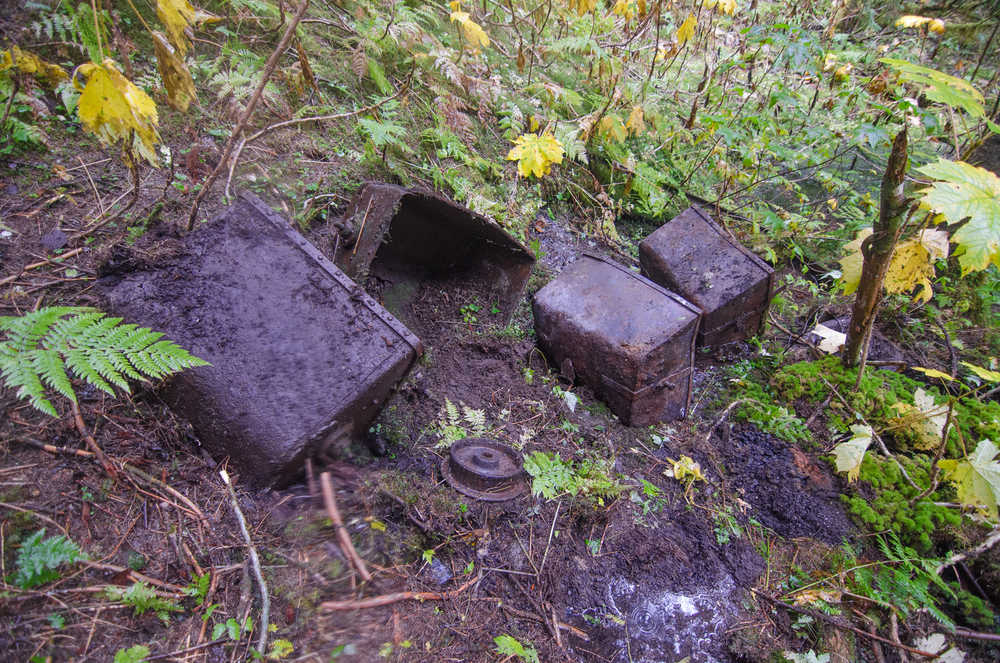
Using a GPS application on my phone called Back Country Navigator, several old pictures, and a map from 1914, I recently visited the site with other members of the hiking group Juneau’s Hidden History to locate the center of town. Greg Taylor, Gerald Hewes and I began to look around the area. Four-inch-thick moss covered everything. Devils Club and alders were also thick on the hillside. After a few minutes of searching the area, it appeared that there were no manmade objects around us. I began to get worried I had messed up on the GPS data, or flipped the image of the town somehow. As my doubt took hold, Greg yelled out that he had found something. It was a 55-gallon barrel that had been converted into a woodstove. Jackpot! Nearby we removed sections of moss from the ground; dishes, pots and pans were uncovered. The foot of a stamp, a wash basin, and then a large boiler were found. With the excitement growing, the group split up and started to grid search the area. Using the old photos of town we began to locate where the buildings once stood. The Machine Shop/Lumber Mill and Blacksmith were located, and the ghost town of Amalga started to take shape. Large pieces of equipment covered in several inches of moss went unnoticed for some time as we walked around them. The remains of Superintendent Thane’s house were located, along with a Risdon 10-Stamp Mill that was not removed from the mine upon its closing in 1915. The moss was carefully removed from the larger pieces of equipment and building ruins. Photos and video were taken during the process in order to show the before and after taking place. Several GPS coordinates were marked on our maps to show where the buildings once stood. The town of Amalga could be seen once more. We spent several hours locating some of the caved adits in the area. Many still had rail tracks running right to them from the town site. After a long day of hiking off trail, up hillsides, and crossing several streams we headed to the Eagle Glacier cabin that we rented for the night. It took me forever to fall asleep. What an awesome day!
Eagle Glacier Trail is located at 27.3 mile Glacier Highway in Juneau Alaska. The trail to the cabin is 5½ miles long. The trail is fairly strenuous but has very little elevation gain. Several washed out sections, fallen trees, and many dangerously slick stairs exist on this trail. With full overnight packs and our packrafts on our backs it took us a little more than three hours from the parking lot to the cabin. The trail continues another 2 miles past the cabin toward Eagle Glacier, but at this time it is nearly impossible to reach the face of Eagle Glacier due to the steep cliffs on either side, and quicksand-like silt at the river delta. As you hike this trail remember the miners that came before you. They left a lot of history behind. Enjoy it while you can; it will not be here forever.

