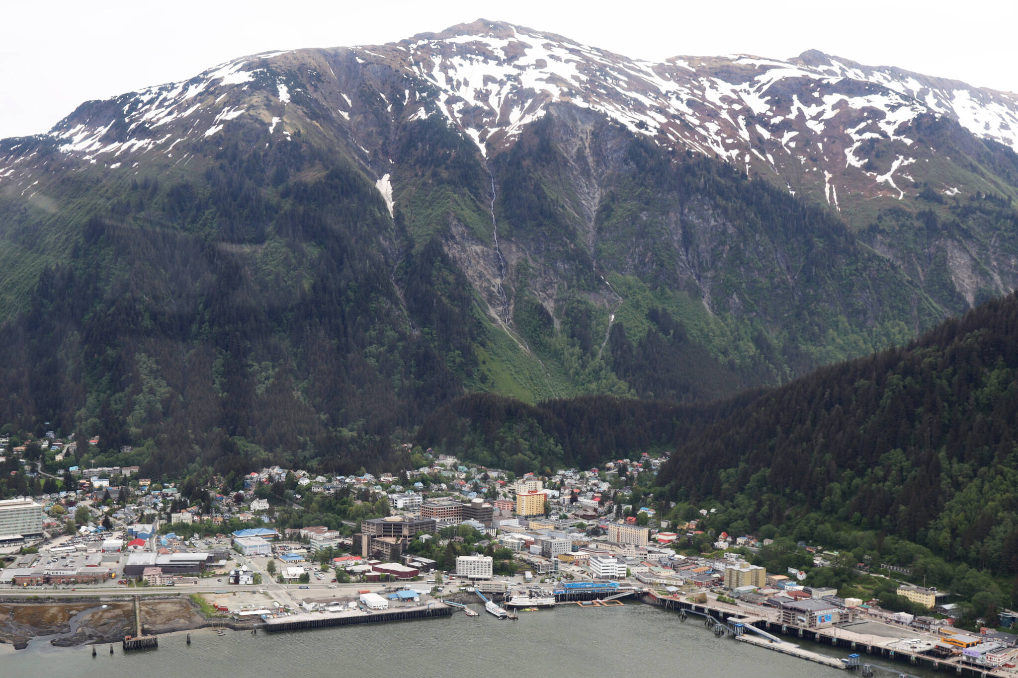
The Assembly unanimously decided Monday night, meeting as Committee of the Whole, to not adopt new maps that show updated landslide and avalanche risk downtown. Instead, the city would be required to conduct annual public outreach and to notify developers in the area of the new maps’ existence.
[Planning Commission urges rejection of new hazard maps and policy]
The ordinance now heads to the full Assembly for public testimony, and will either remain there for a vote in the following meeting or get sent back to committee for further discussion. The move Monday night follows years of discussion and hesitancy on whether to accept the new maps — commissioned by the city in 2018 and paid for by a grant from the Federal Emergency Management Agency — and what regulatory changes and policy implications may flow from the updated avalanche or landslide-prone zonings.
CBJ’s current hazard maps, adopted in 1987, are based on maps created in the 1970s. Under the new maps the number of properties that move into high/severe landslide zones grows from 173 to 374, including 217 properties that were not included in the 1987 severe zone.
Since the release of the maps to the public, many property owners in the affected areas have expressed concern about adopting the maps, and that a new hazard designation could affect property values, resale options and insurance costs. Those concerns were discussed among the Assembly members Monday night and were a driving force behind members’ decision to move forward without its adoption.
Assembly member Greg Smith said he thought the decision to require public outreach and not adopt the maps was the “least worst option,” arguing that adopting the maps would unfairly impact people who are in that study area as there hasn’t been a full assessment of similar risks across the borough.
“If we are starting to regulate people based on this little sliver of town that we’ve only studied I will probably oppose that all the way to the end,” he said. “But I am OK with this and to hear from the public.”
Mayor Beth Weldon shared a similar viewpoint.
“Downtown is not the only place we have problems,” Weldon said. “We have problems in Douglas, North Douglas, anywhere that there is a slope.”
However, Assembly member Loren Jones, who is filling the remainder of recently resigned Carole Triem’s seat until the election, said he wasn’t going to object to the motion as it was still in committee, but said if it was a decision at the full Assembly, “I certainly would be a no.”
“It ignores some responsibility we have for public safety, especially if we want more density in downtown housing,” he said. “It’s OK to notify the owner, but what about the 40 other residents of the apartment if something happens? Nobody thought the (Suicide Basin) floods would happen at the Mendenhall (River), but it happened.”
Jones said if members of the Assembly and city administration don’t believe that the new maps are accurate “don’t put them on the website.”
“People are going to look at something official on the website of a government and assume that the government supports it,” he said. “I think you have some serious, serious public relations problems by putting maps that you do not officially believe in on the webpage and say ‘OK, public, beware, but we take no responsibility for anything that happens to you or your renters, citizens or family.’ I think that’s skirting the responsibility of the government and that’s just wrong.”
Assembly Member Wade Bryson said he agreed that he doesn’t want to see the community develop in harm’s way, but at the same time “we do have property owners, we owe them an answer to properly navigate this so homeowners can make decisions on what they want to do with the property that they own.”
Bryson argued the decision should be up to the individual property owners to assess whether they want to take the risk.
“We all have some risk no matter where we live and I don’t think any government action is going to absolve us of that,” he said.
Assembly member Alicia Hughes-Skandijs said she similarly wouldn’t object to the ordinance from moving to the full Assembly so as to allow for public comment, but said “to not adopt something, but then refer to it seems a little crazy to me.”
The Sitka Assembly went through a similar difficult decision-making process when after deadly landslides in 2015 it commissioned landslide mapping to assess risk and later adopted a new section of city code with restricted development in areas with “moderate” or “high” landslide risk.
However, in 2021 the Sitka Assembly unanimously agreed to remove that language about landslide management from the city code, with the Sitka administration saying it was causing unanticipated challenges to homeowners in the area.
• Contact reporter Clarise Larson at clarise.larson@juneauempire.com or (651)-528-1807.

