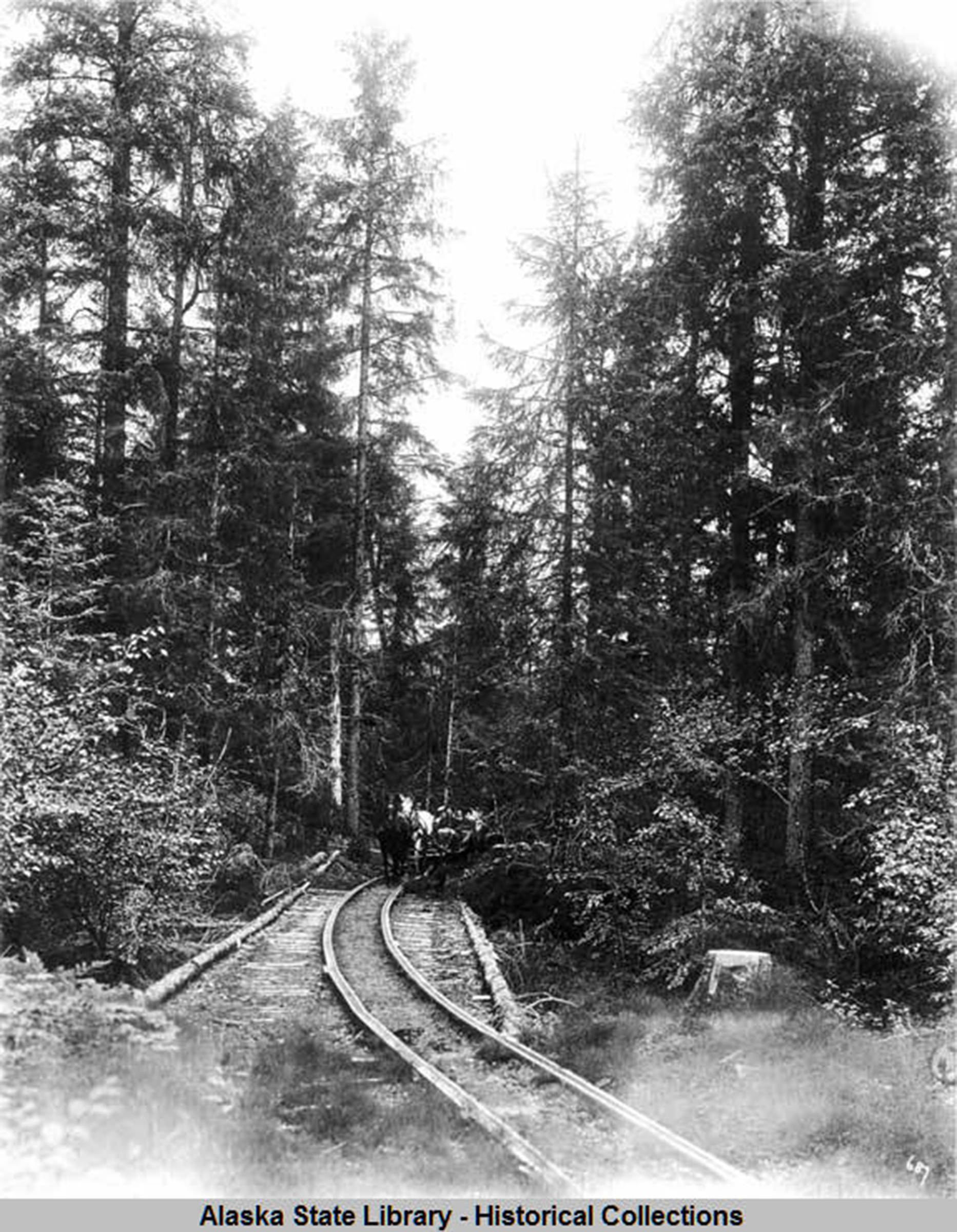
In the early 1900s, exploring gold miners discovered good prospects near Eagle Glacier, ultimately establishing the Eagle River Mine and the settlement of Amalga.
To service the settlement and the mine, a horse tram ran between there and a salt-water cove with a good landing beach for boats. The horse tram route went from the landing beach, over into the west side of the big meadow near the Eagle Valley Center, northward over the low pass toward Herbert River, over that river and up the flood plain, eventually crossing Eagle River and reaching Amalga.
The mine and settlement lasted less than three decades but left a residue of scrap metal and other junk behind. The steel rails of the horse tram are still to be seen, in places, and the dike that raised the rails above the wet meadow is still there (now sporting a row of small trees).
City and Borough of Juneau decided to make a trail connection between the Eagle River Landing beach and the Boy Scout Camp/Crow Point trail that goes along the lower Herbert River. This connecting route avoids the big meadow, which is home to interesting wildlife and plants. Instead, it goes from the landing beach on an existing informal trail up a hill and through a small muskeg, rejoining (approximately) the old horse tram route on the north side of the low pass. Total length is about a mile and three-tenths.
Most of the new route is presently a morass of mud roiled up by hikers’ feet, but this year Trail Mix Inc. has begun some serious trail improvement. Just after the first bridge on the Boy Scout Camp trail, a wide, packed-gravel trail starts up the hill. It soon parallels part of the old horse tram route for several hundred yards; the tram route itself has become an eroded drainage ditch that channels water down the hill. Broken branches, rocks and other debris line the new trail, waiting to be covered by mosses and lichens. Not far from the end of this year’s work, there is a junction, where the old tram route goes over the low pass to the big meadow and the new route heads up the hill.
Coming up the other side of the hill, from the landing beach, the trail crosses a small creek and turns up a route that was partly graveled some time ago. As it approaches the top of the hill, however, cribs made of logs await loads of gravel to fill the mud-holes that the cribs now guard. The first layer will be gravel from the beach; that will be topped by the same kind of gravel that surfaces the rest of the trail. I’m told that it takes a Corps of Engineers permit to put gravel down on a trail — does all of Juneau qualify as a “wetland”?
CBJ hopes to connect the two ends of this trail next year (2020). In the meantime, a new spur trail has been cut and graveled to a new clear-cut above a rocky beach not far from the landing beach. CBJ intends to build a cabin there: supported on concrete posts, the cabin will be built from an Icy Straits kit, delivered to this beach by landing craft. It will resemble the cabins at Eagle Beach State park but have a larger deck; the view will be very pleasing. The cut timber will be used to build an outhouse. CBJ hopes to have the cabin available for rental (from Parks & Rec) by next summer.
Two other CBJ trail projects have been funded and are planned for next year. The Amalga Meadows Trail (a short six-tenths of a mile) from the Eagle Valley Center to the Eagle River Landing beach will get a new bridge over the slough, probably next year. The Brotherhood Bridge (Kaxdigoowu Heen Dei) will get a new section that reroutes the beginning of the trail at some distance from the Mendenhall River, avoiding the rapidly eroding bank. The new trailhead is at the north end of the parking lot; the new section goes right across the meadow and joins the existing trail where the forest begins. It should be paved next spring. The entire trail will be repaved and the eroding bridge over Montana Creek replaced, possibly beginning in 2021.
Other projects on the CBJ list still require funding, so (I’m guessing) perhaps by the time full funding becomes available, still other projects will be on the list. But for now, work is planned for the Switzer Creek trail system, the Lena Point trail and the Rain Forest Trail on North Douglas.
• Mary F. Willson is a retired professor of ecology. “On The Trails” is a weekly column that appears every Wednesday.
• Mary F. Willson is a retired professor of ecology. “On The Trails” is a weekly column that appears every Wednesday.

