

Editor’s note: With planning of a second Juneau-Douglas crossing underway, this is a look at how the main thoroughfare linking downtown and the Mendenhall Valley was created through some of the same area now being assessed.
Before Egan Drive opened in 1975, commuting between Mendenhall Valley and downtown on Glacier Highway felt like a funeral procession traveling at the speed of the slowest driver, and everyone knew who they were.
The bumper-to-bumper commute could take an hour from the valley to downtown in the morning, one Juneauite recalled, and slipping off the edge of the pavement could dump you into Gastineau Channel if the tide was high.
As frustrating as driving the old Glacier Highway was 50 years ago, when it was first built in the early 1900s it was a welcome link to the Mendenhall Valley. The pressing need for the road was the demand for electricity to power the area’s big gold operations. Hydropower was the key. Salmon Creek and Nugget Creek were the sources. A road was needed to get supplies and laborers to the farthest site 15 miles away at the Mendenhall Glacier. Through spruce forests, tidal wetlands and glacial silt, pioneers cut the road, built bridges and filled muskegs.
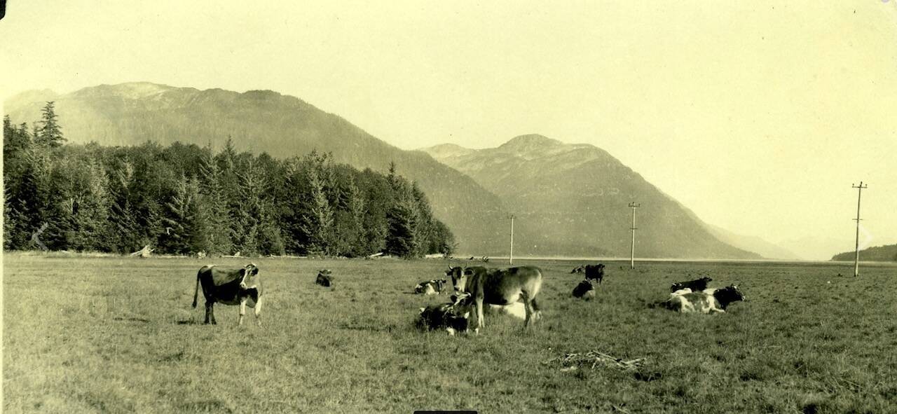
A 1927 historical photo of George Danner Sr.’s dairy cows near today’s Juneau Christian Center and Fred Meyer. (Courtesy www.juneauhistory.com)
Photos telling the story of the first road were almost lost. Seventy years ago janitor Art Paulson found an album containing 260 photos in a trash can at the Alaska State Capitol. He handed the retrieved album to George Danner, an architect who worked in the building. In 2016, a Danner family member with historian Jim Geraghty scanned and posted all the photos — including the Danner cows — on a website (www.juneauhistory.com).
The grassy wetlands provided good grazing for dairy cows. Several dairies existed to serve the growing families employed by the mining companies. By the 1950s, a poultry farm in lower Mendenhall Valley offered fresh eggs from Hurlock’s Happy Hennery. Some early barns remain today, now converted to new uses. One of the largest dairy barns was owned by the Smith Family. Today Nugget Mall, built in 1974, is on the land that still had a long wooden dairy barn when the first downtown phase of what was first called Outer Drive or Glacier Expressway was opened in 1969.
As designs for a new highway between downtown and the airport were investigated, sources of fill material were studied. The obvious source was Gastineau Channel. Construction in the tide flats required advanced engineering to cope with the extreme tides measuring over 20-plus feet of high water and then dropping in six hours to minus four feet. Engineers needed to design culverts and bridges for high volumes and velocities of seawater, as well as freshwater runoff from glaciers and mountain valleys.

Sarah Dittman paints a watercolor scene of the wetlands as Ela Gonzalez watches. They are seated beside the Egan Drive pullout near the Rotary Club observation deck. (Laurie Craig / Juneau Empire)
A dredging experiment during 1959-1960 in Gastineau Channel demonstrated the difficulty of working with active tides in the narrow waterway. The goal was to create a navigable channel for boats to pass over shallow submerged land between downtown and the airport. If successfully dredged, the commercial fishing fleet, as well as other vessels, could save miles of motoring around Douglas Island. The high tide route was known as “crossing the Mendenhall bar.”
During the early dredging the east end of the airport’s diked floatpond was breached and all the water drained out. It was repaired. But the dredging experiment failed. Almost immediately, the trench filled in with sediment and glacial silt. Keeping it open would be too costly. During the two-year operation, dredged material was dumped into piles that now — 60 years later — are picturesque forested islands ringed with fireweed fields in July.

Golden grasses of Mendenhall Wetlands on Sept. 17 looking toward downtown with Egan Drive and the Douglas Bridge in the left distance. (Laurie Craig / Juneau Empire)
There was strong community support for creating a navigable channel between Douglas Island and the mainland. In hearings about the future four-lane, residents said dredging could provide useful fill for the new road while opening a safe route for boaters crossing the bar. At a U.S. Army Corps of Engineers hearing in about 1969 dredging was discussed again. One tugboat captain who first used the shortcut in 1919 spoke of towing two to three barges behind his tug “Champion.” He also towed 72-foot wide log rafts through the shallow strait.
He asked that the Corps dredge a channel that was as “straight as a bullet” and at least 75 feet wide. There was enthusiasm for opening this area. The Coast Guard spokesperson noted, however, that the Sweetbriar couldn’t get under the bridge. Some wanted the state ferries to pass through the narrow channel as well as steamships. The route would be safer from bad Taku weather and faster.
Today it seems unbelievable that barges and rafts of huge logs could be towed by tugboat through the shallow channel. More people walk across it at low tide than motor in their boats. A popular foot race started in 1982 sends runners in their muddy sneakers during low tide in May from Douglas Island to Juneau in the “Springtime Scramble.” Nevertheless, mariners today still attempt the shortcut, often with embarrassing results when their boats run aground and remain in place until the next larger tide — sometimes a wait of a couple of weeks or more — rises enough to refloat their boat.

Boats attempting to “cross the Mendenhall bar” at high tide, short cutting the route between downtown and Auke Bay occasionally run aground and get stuck as this sailboat did for several days in 2007. (Laurie Craig / Juneau Empire)
To understand the tidal action of this narrow reach before dredging or designing the road, the Corps built a model of the crucial seven miles of channel at their Vicksburg, Mississippi, Waterways Experiment Station.
“The model must have been a quarter of an acre in size,” wrote former Department of Highways (now DOT) alignment engineer Jim Nelson, in a September 2024 email as he recalled the project. The model “was built out of concrete to duplicate the contours of the channel. They could introduce water to the model simulating the rise and fall of the tides. They added a plastic flour material to the model and after running many tide cycles, they could observe the shoaling conditions of the sand.”
Shoaling is the shallowing build-up of sediments. The modeling determined a long dike could be built that would block the silt and sand from flowing into the channel. Dredging would open the navigation route while providing fill for the new Glacier Expressway.

A Department of Highways map from 1975 showing the completed route of Egan Drive through Gastineau Channel. (Alaska Department of Transportation and Public Facilities)
Before that work began, however, a controversy was brewing over where the four-lane would be situated. The conflict was which route to select crossing the wide tide flats draining Vanderbilt, Lemon and Switzer creeks. All of these streams contribute to salmon productivity and duck hunting habitat. The proposed “outer route” ran through wetlands from Vanderbilt Hill outside Sunny Point to the airport. It was strongly endorsed by many prominent businessmen. Others argued several valuable acres of estuarine fish and wildlife habitat would be lost as well as waterfowl hunting. They preferred the “inner route” which kept the road as close as possible to the existing Glacier Highway. Biologists said the wetlands were one of the few “marsh-tidelands between the Gulf of Alaska and the Fraser River Delta” in Canada and essential to meeting international migratory bird treaty obligations for habitat and flyways. Occasionally, the hearing transcript resembles a dramatic courtroom scene from a movie.
Two more arguments supported the inner route. First, the issue of airport safety was raised by a pilot who said the proposed Sunny Point route could be a problem. The inner route would be better to keep birds away from the airport and reduce bird-strike hazards. Second, another person presented an economic analysis that showed the inner and outer routes were similar in costs.
Perhaps the most persuasive testimony came from high school students who had taken a poll in 1968. The Wildlife Club said that 90% of the Juneau-Douglas High School and Marie Drake junior high school students used the wetlands for duck hunting, fishing, riding, walking and recreation. They wanted the wetlands preserved as much as possible.
On Aug. 20, 1970, the state determined, “The design of this project has been influenced by comments received by the Department of Highways during and immediately after the corridor public hearing that was held in March of 1969. Upon analysis of the data presented at this hearing the Department of Highways selected the alignment known as the inner alignment or the one paralleling Glacier Highway at Sunny Point.”
Egan Drive was constructed with rock berms filled with dredged material from Gastineau Channel, seen here near Lemon Creek in March of 1973. (Photo by Skip Gray)
Once the route decision was made, dredging was approved by the Corps. Rock berms were built and channel fill was pumped through 20-inch diameter pipes from a floating pontoon dredge to fill the space between the berms. Dredged material dewatered itself and compacted firmly. Rock was quarried from a site near the hospital which is used today by other medical campus buildings. The large borrow pit near TEMSCO was used for filling the highway portion from Sunny Point to the airport.
The lengthy discussion about wetlands recognized that no protection existed for the estuary and its valuable role for marine life and human enjoyment. Subsequently, legislation was proposed to preserve the area. Once again students played a major role. They spoke up in hearings of the Alaska State Legislature in support of establishing the Mendenhall Wetlands State Game Refuge. Their voices made a significant impact in passing the legislation in 1976. Today the first few days of Juneau’s waterfowl hunting season are reserved for youth.
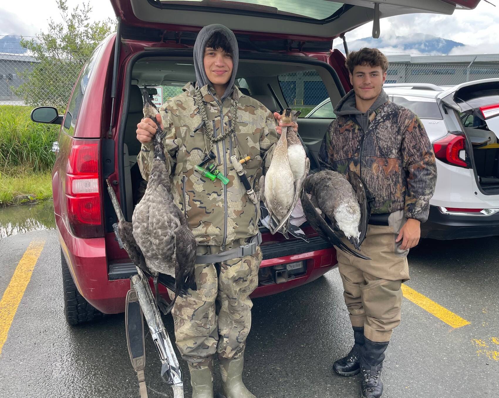
Juneau-Douglas High School: Yadaa.at Kalé students Justin Geary and Justus Darbonne, both 17, show ducks and geese they hunted on Sept. 2, 2024, during the waterfowl season opening reserved for youngsters. Students were crucial to the successful passage in 1976 of legislation establishing the Mendenhall Wetlands State Game Refuge. (Laurie Craig / Juneau Empire)
The final expressway was completed in 1975. The day before it was opened, the smooth pavement proved too tempting to ignore. Two young adults snuck onto the closed highway and rode their bikes the entire length.
Other topics were raised such as removal of the blocky concrete foundations that stand along Vanderbilt Hill Road and the Pioneer Home. They were too costly and damaging to remove so they remain as idle memories of a failed Alaska Communications White Alice tower and its many anchored guy wires. Originally there were 40 huge blocks.
Due to several new intersections being formed where Glacier Highway met Egan Drive a manner of designating them was needed. Although nothing official was done the most well-known intersection was dubbed “McNugget” by KINY Radio’s popular morning personality Warren Wiley, also known as “Uncle Fatz.” The name originated by combining the “new” 1974 Nugget Mall with the McDonald’s Restaurant.

Two fishermen and a dog wade through Gastineau Channel from Douglas an hour after a 3.4-foot low tide on Sunday, Sept. 8. (Laurie Craig / Juneau Empire)
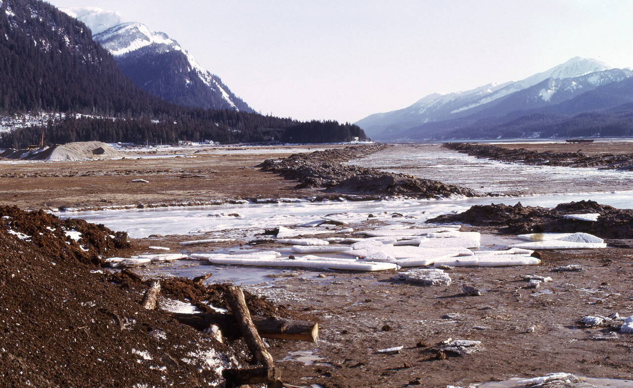
Perhaps some future residents will renew the effort to dredge a navigation channel through seven tight miles of shallow water that continuously fills in. But they would need to contend with an issue not addressed in 1970: isostatic rebound. No mention was made of this natural phenomenon of rising land that results from glaciers that melted hundreds and thousands of years ago. According to retired UAS geology professor Cathy Connor, land around Juneau since 1970 has risen almost three feet. That rise has created golden grasses in September as drivers safely commute on Egan Drive, and occasionally think about choices made nearly 50 years ago and the views enjoyed today.
• Contact Laurie Craig at laurie.craig@juneauempire.com.
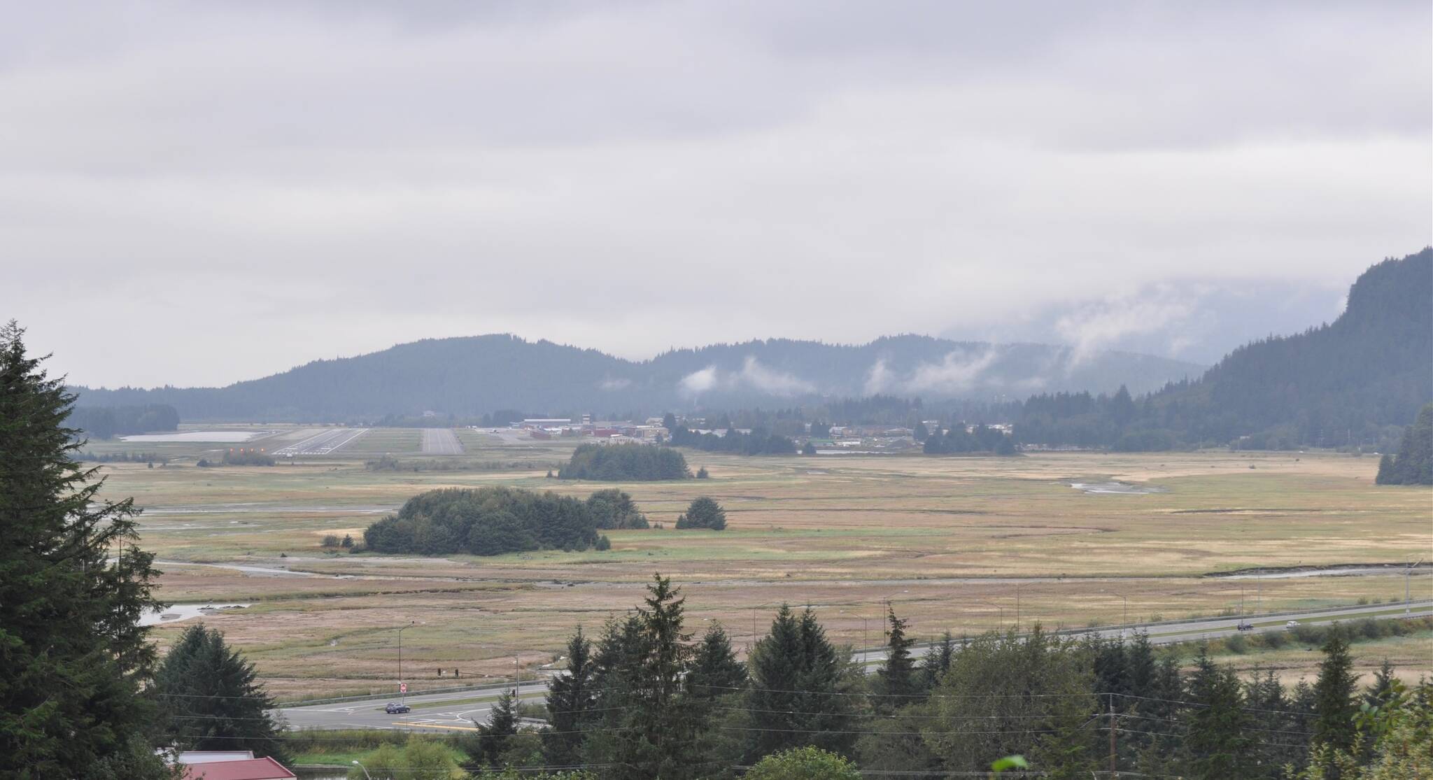
A view from the Vanderbilt Hill area of the wide sweep of tidelands by Lemon Creek with forested dredge islands and Juneau International Airport on the left. Egan Drive is in the foreground. (Laurie Craig / Juneau Empire)
