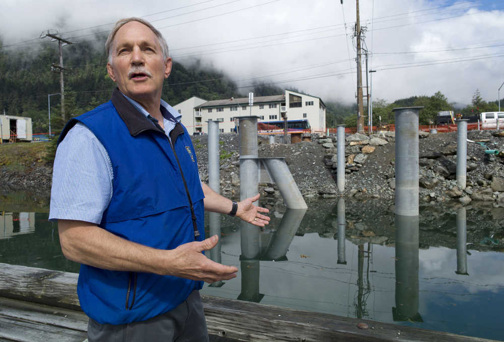
The closest thing Alaska has to air-traffic control for ships is getting a new control tower.
On Thursday afternoon at the Juneau Moose Lodge, Marine Exchange of Alaska Executive Director Ed Page told the weekly crowd at the Juneau Chamber of Commerce luncheon that a three-story tower will soon rise from the edge of Harris Harbor.
Sleek and modern, the tower will be the flagship of an operation unlike anything else on Earth.
“There’s no other vessel tracking system this large in the world,” Page said.
From its control room in Juneau, the Marine Exchange tracks every vessel in Alaska waters that carries a small transponder — and almost every boat larger than 65 feet carries one.
[STORY: Alaska’s mariners benefit from technological advances]
On display screens in the Exchange’s second-floor offices above Juneau Electronics, ship-shaped icons are sprayed across a map of Alaska. There are fishing boats, tankers, freighters, cruise ships and more. They’re close to shore and far out to sea.
Some of the icons seem scattered almost at random. Others form defined and regulated lines marking shipping routes that stretch north from California, through the Aleutians, and disappear off the chart in the direction of China and Japan.
“It’s like I-5 out there,” Page said on a tour, referring to the California Interstate highway.
In speeches and on tours, Page compares the Marine Exchange’s operation to ones run by national governments around the world. Norway and Iceland have something similar, but they only have 60 or so tracking stations. The Marine Exchange has about 130, monitoring everything from the Bering Sea to Dixon Entrance and the far tip of the Aleutians.
The government of Australia runs a high-tech monitoring system that supervises every boat near the Great Barrier Reef.
“It’s 100,000 square miles of water that they’re monitoring. We’re monitoring 1.5 million square miles, with a little, small nonprofit organization with 20 people in Juneau, Alaska,” Page said.
[STORY: Juneau tech works to avert world’s shipping disasters]
In the 15 years since its founding, the Marine Exchange has become a critical piece of Coast Guard operations and American monitoring of Arctic waters. When government agencies or port planners want to know how many ships are sailing through the Bering Strait, they contact the Marine Exchange. When a ship enters Alaska waters and needs to know the correct route, it contacts the Marine Exchange. If a ship breaks down in Alaska waters, the Marine Exchange sees it and can notify the ship’s owner in London or Singapore.
The Marine Exchange collects, sorts and displays its information, then sells access to shipping companies, governments, the U.S. Coast Guard and anyone else with an interest in the ability to turn on a computer or navigation plot and know exactly what ships are nearby and what they’re doing.
“If you turn off the switch right now, the Coast Guard’s going, where did the ships go? Where are my own ships?” Page said, referring to the way the Coast Guard relies on it. “It’s amazing how much information we’re bringing in here.”
[STORY: Marine Exchange earns public service award]
Fifteen years ago, Page, Paul Fuhs and a handful of others started the Marine Exchange of Alaska as a way to share information about vessel locations.
Fuhs was a diver in Dutch Harbor; Page was the chief of marine safety and environmental protection for the Coast Guard in the Pacific.
While both were in the Aleutians, the fishing vessel Arctic Rose sank in the middle of the night, killing all 15 people aboard. There was no distress call for help, and the only sign that something was awry came when the ship’s emergency locator beacon sent out a ping.
By the time the Coast Guard overflew the site, it was too late — the water of the Bering Sea was too cold to support life for long.
Tragically, the Arctic Rose’s sister ship, the Aleutian Rose, was only six miles away, “and nobody knew about it,” Fuhs said by phone on Thursday.
“We said, ‘We need to do something better than this,’” he recalled. “That’s how it started.”
Each new tragedy has given the Marine Exchange another boost. After the Selendang Ayu disaster in 2004, the Marine Exchange was a key agency in laying out shipping routes through the Aleutians — which are on the shortest route between the West Coast and Asia — then enforcing them with electronic fences that are triggered if a tracked ship goes the wrong way.
It’s tracked Yu’pik and Inupiaq whaling boats, and skiffs working in Southeast Alaska. It’s a remarkable experience, Page said, to be out boating and have a cruise ship be able to identify your skiff and radio your boat by name and talk to you.
“It’s gone way beyond what I thought, which is way cool,” he said. “Our office is not really adequate for what we’re going to be doing.”
That’s why, over the next few months (Page is eyeing an opening in June), the Marine Exchange’s new headquarters will take shape. “We’re pretty excited about it,” Page said. “It’s like the gateway to Juneau.”
• Contact Empire reporter James Brooks at james.k.brooks@juneauempire.com or 523-2258.
—
Get more news:
Optimism and pessimism collide among Alaska’s telecom leaders
State Representative triggers investigation over Beyoncé image

