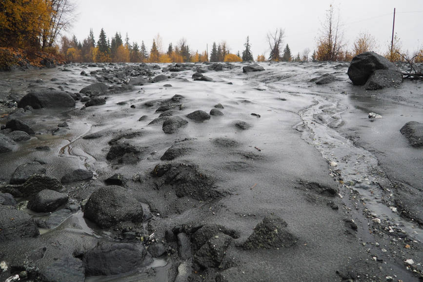
A soggy weekend led to mudslides and high water across northern Southeast, but the atmospheric river that delivered the rain brought little relief to parched southern Southeast.
“It’s an injustice, but it’s nature’s injustice,” said Wes Adkins, a forecaster with the National Weather Service in Juneau.
Heavy rain fell across northern Southeast on Saturday and Sunday, leading the National Weather Service to issue a flood advisory as rain-swollen creeks and rivers filled their banks and approached flood stage. While low-lying areas were waterlogged, the end of the heaviest rain meant water levels began falling in the afternoon.
On Sunday, the weather service gauge at Juneau International Airport recorded 1.75 inches of rain, setting a record for that date. (The old record for the airport, the city’s official measuring point, was 1.13 inches, set in 1997.) Sunday’s rainfall followed 0.64 inches on Saturday.
Those two days combined brought more rain to Juneau than fell in all of September, which recorded a record-low 2.22 inches. Through Monday morning, October’s rainfall has run more than half an inch above normal. Overall this year, Juneau has been much drier than normal. Through Monday morning, the capital city is more than 7 inches below its normal precipitation (rain and melted snow) for this point in the year.
The airport was comparatively dry compared to the Mendenhall Valley, which received 4.88 inches of rain over the weekend, and downtown Juneau, which received 3.91 inches. Douglas had 5.12 inches of rain, and 6.4 inches of rain was reported at Annex Creek.
Jordan Creek overflowed its banks and flooded parking lots at the nearby commercial center. Small mudslides took place along Gastineau Avenue and Basin Road.
Check out the rain totals from the #AtmosphericRiver of October 13-15. A whopping 14 inches of rain in Pelican while #Ketchikan and the south, who need rain desperately received only drops. #drought .@KTOOpubmedia .@KRBDRadio .@JuneauEmpire .@800KINY .@KHNS_FM .@ravenradio #akwx pic.twitter.com/JiPn6N7iJJ
— NWS Juneau (@NWSJuneau) October 15, 2018
Beyond Juneau, conditions were soggier. At the Glacier Bay National Park headquarters in Bartlett Cove, near Gustavus, instruments measured 7.31 inches of rain, and Pelican had an astounding 14.44 inches, courtesy of a weather system that channeled moisture from the central Pacific through Icy Strait.
North of Klukwan, a pair of mudslides blocked the Haines highway for several hours Sunday. Department of Transportation spokeswoman Aurah Landau shared photos and video of the slides and said a slide at 23 Mile was about 100 feet long and up to eight feet in places.
Haines Highway cleared off and reopened after 2 mudslides pic.twitter.com/ziqHNoypZe
— Alaska DOT&PF (@AlaskaDOTPF) October 15, 2018
A volunteer staffer at Gustavus city hall reported high water in creeks, ponds and streams but said roads remained passable. In Pelican, Cindy Beamer said “a typical rain gauge just won’t do” in conditions like this weekend. No boats sank, she said, and while one gravel road washed out, the damage wasn’t bad.
“We have plenty of water for our hydro,” she said.
That isn’t the case in southern Southeast, where a drought covering Ketchikan is continuing to intensify. Last week, the federal government’s drought monitor declared Ketchikan, Metlakatla, Prince of Wales and the rest of southern Southeast to be in a severe drought.
Ketchikan has had 3.01 inches of rain so far this month, but in a normal month, it would have had 7.6 inches by this point. Since the start of the year, Ketchikan has had only 72 percent of its normal precipitation. Wrangell, Metlakatla and other southern Southeast communities have also seen lower-than-normal rainfall this year, with effects for electricity companies, fishermen and drinking water systems.
• Contact reporter James Brooks at jbrooks@juneauempire.com or 523-2258.

