Joan Rosos knows warm weather well from her homeland Philippines and years of working on cruise ships visiting tropical ports — and Juneau’s current heat wave that saw record temperatures Tuesday and Wednesday definitely qualifies.
Rosos, taking a break from her duties aboard the Noordam by stopping for ice cream in Marine Park with two co-workers, said there haven’t been a lot of days hovering around 80 degrees during her port stops the past three summers in Juneau.
“It definitely feels hot,” she said.
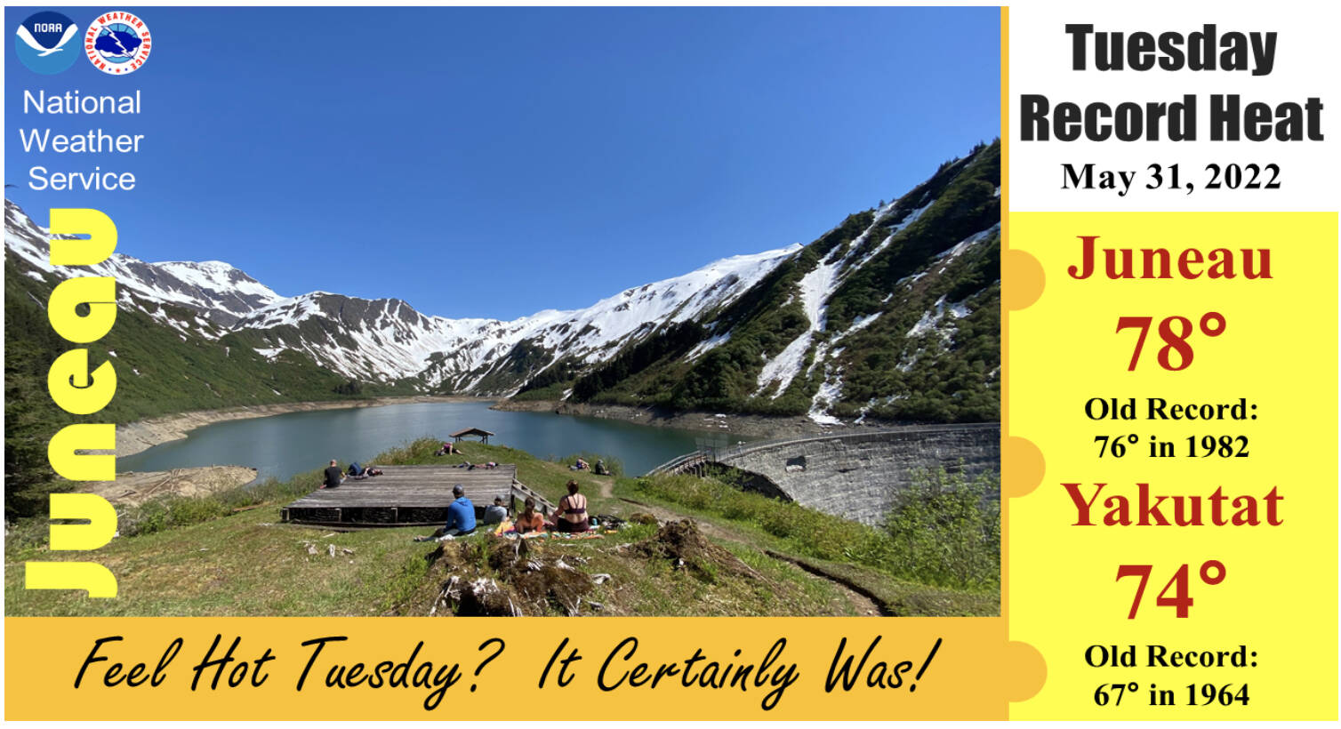
A heat wave that hit Juneau during the second half of May topped out with record highs of 78 degrees at Juneau Airport on Tuesday and 79 degrees on Wednesday, topping previous records of 76 degrees set in 1982 and 78 degrees set in 1958, respectively, according to the National Weather Service in Juneau.
Thursday’s forecast calls for a high temperature of 83 degrees, with the current record for the date being 82 degrees in 1946, “so we have another potential record day,” said Grant Smith, a meteorologist for the weather service.
Yakutat also set a record on Tuesday at 74 degrees, far exceeding the previous high of 67 degrees in 1964.
The record-high days are part of a longer-term trend during the second half of May – and, indeed, in the forecast for this summer and a general long-term climate trend, said Jon Suk, another meteorologist at the Juneau Weather Service office.
“The month started off cool, but then ended up warming up quite a bit,” he said. “We really saw that dry spell carrying on in the second half of the month. We’re going to be seeing that continue on through (early) June.”
Cooler temperatures should arrive in Southeast Alaska by Friday and reach Juneau by the weekend, Suk said.
“What they’re showing is we’re not going to be locked into a long, dry, hot pattern,” he said.
Looking ahead to the long-range summer forecast, which relies on climate rather than weather data, it appears Juneau residents and visitors can still expect more relative heat, Suk said.
“What we’ve been seeing from them is generally a trend that’s putting us at a chance for warmer conditions,” he said. “Precipitation-wise they’re actually keeping us at a slightly increased chance for above-normal precipitation as well.”
The temperature increases and weather patterns aren’t consistent throughout Southeast Alaska, especially when examining month-to-month patterns, with Ketchikan seeing significantly higher precipitation than normal, while Sitka “is so close to the Gulf they’re getting socked in with marine air, and it gets overcast and cloudy, and stays cooler the whole day,” Suk said.
Juneau and other locales experiencing heat waves and dry conditions aren’t merely reason to relish a suntan — or curse a sunburn. The weather service has issued fire danger alerts for much of the region, including an elevated red-flag alert for the Haines region.
“Fine fuels are dry and there is a risk of camp fires getting out of control,” the alert for the Juneau region notes. “Winds will remain light, which is a mitigating circumstance working in our favor. All individuals are encouraged to be mindful of the dry and warm conditions during the remainder of this week.”
• Contact reporter Mark Sabbatini at mark.sabbatini@juneauempire.com.

