Captain Ed Page, the Executive Director of the Marine Exchange of Alaska, stood on the roof of their new $4-million facility on the edge of Harris Harbor.
“I think I’ve overshot the mark,” he jokes. “The building is impressive, but the people are more impressive. I am trying to catch up to the talent of my staff.”
Three stories of contemporary design and plate glass on the Juneau side of the Douglas Bridge, the new MXAK building has been turning heads since construction began last year. The private nonprofit has just moved in and started operations from their new location last week.
MXAK monitors vessels — everything from huge cargo ships to fishing vessels and Native whaling boats — on more square miles of ocean than any organization of its kind in the world. It’s an area stretching from the Dixon Entrance to the Beaufort Sea.
The MXAK’s most important job is to look for signs of distress, like a vessel suddenly slowing down, stopping or changing direction. They also spot violations of maritime policy, an international cargo ship coming too close to shore, for instance.
Australia has a similar monitoring system for the Great Barrier Reef, which keeps track of about 100,000 square miles of sea. MXAK looks after 1.5 million square miles, all with a staff of only 19.
Their old facility, located above Juneau Electronics, didn’t match the scope of their operation.
Page laments directing visiting dignitaries like U.S. Sen. Lisa Murkowski to a portable toilet, located in the parking lot and made necessary by plumbing problems in their old offices. There, staff couldn’t use the hot water and make coffee at the same time.
“This is the biggest vessel compliance system in the world. So when you think of that context, you would think we should look like that. So that’s what this is really about,” Page said.
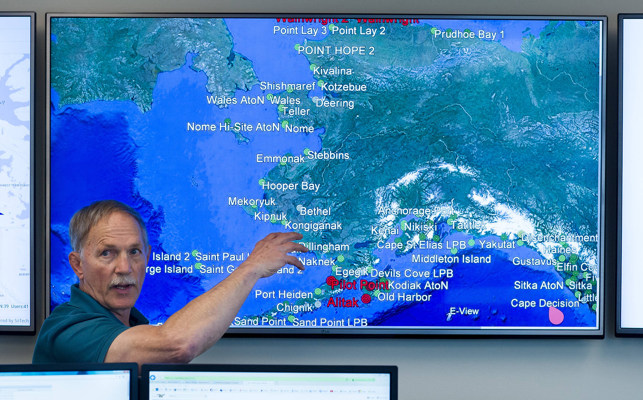
On the second level is a new operations center, where MXAK watchstanders monitor vessels in 12-hour shifts. Six large computer monitors and four flat-screen TVs show various maps and charts of Alaska and the North Pacific. One is strewn with hundreds of colored isosceles triangles, each marking a ship. Two parallel archs of green triangles mark the paths of cargo ships crossing the Pacific. Much closer to shore, blue triangles show the position of fishing boats.
On Friday, watchstander Michael Patterson and supervisor Jennifer Karnik were on shift.
“A vessel is going 20 knots (nautical miles per hour) and all of a sudden it drops down to 3 knots, that’s something we’re looking out for,” Patterson said. “I tell friends we’re kind of like the FAA (Federal Aviation Administration) but we don’t tell them where to go, it’s more of an eye in the sky kind of deal, we make them feel warm and comfortable inside. They know that somebody is watching out for them.”
Patterson and Karnick look out for about 1,000 organizations, including the U.S. Coast Guard, Trident Seafood and Lloyds of London. Each of these agencies installs tracking devices on their vessels, which relay information through 150 vessel monitoring stations located throughout the state.
The system relays weather information, and in cases of distress, alerts good Samaritan vessels close enough to assist with a rescue or repair. They will also pass on sightings of marine mammals, which are protected by federal law, so ships can better avoid them.
Patterson said that when he first interviewed for the MXAK, he had the same misconception that many have: he thought the Coast Guard did work like this. The Coast Guard does monitor vessels, Page said, but those that don’t stop in a U.S. port can sidestep Coast Guard regulations.
Because the MXAK is a voluntary service, they can monitor cargo ships just travelling through.
“We don’t go into heavy seas to rescue people and we don’t write tickets,” Page said.
“There’s no requirement, outside of U.S. territorial waters, to notify the Coast Guard. We basically have more latitude, in some cases. We’re going to say ‘you’re going to enroll in the system, these are the rules of engagement, and we’re going to hold you accountable to those.’”
Part of the logic behind the new facility was to raise the profile of the MXAK’s work. Page wants to use the facility to educate young people on maritime careers.
They’ll also be working on dealing with increased traffic through the Arctic, which shipping companies have utilized increasingly as Arctic sea ice continues to melt. But only about 500 vessels a year currently pass through U.S. Arctic waters, Page said, and the increase in traffic has been a “slow progression.” By way of comparison, about 9,000 vessels a year pass by Juneau alone, Page said.
The MXAK can pass on satellite maps of sea ice, allowing boats in Arctic waters to avoid icebergs. They’re currently working with the Coast Guard to build new tools to deal with increased traffic.
“The tools we build now apply to the Arctic. But that has been a focus, to close the door before the horses get out,” Page said.
• Contact reporter Kevin Gullufsen at 523-2228 or kevin.gullufsen@juneauempire.com.

