
Over the past ice age, glaciers sculpted Southeast Alaska into the dynamic and awe-inspiring landscape we see today. Dramatic fjords and steep forested hillsides jut up from the ocean. The forests that have taken root here only have a shallow layer of topsoil to cling to above bedrock.
Along with the growing forests a vibrant and complex culture of people have thrived. The Tlingít, Haida, and Tsimshian people have tended to Southeast Alaska since time immemorial, shaping the land and being shaped by it in turn. As an abundant temperate rainforest heavy precipitation is part of the land and livelihoods of the people. When heavy rainstorms saturate the topsoil it can become unstable and the risks of landslides are all too clear.

Hoonah seen from a mountainside. (Photo by Lee House)
The end of summer 2015 saw a large storm that carried high precipitation levels and triggered over 40 landslides across Baranof and Chichagof Island, one of which resulted in the loss of three lives. This tragic event served as a catalyst for the creation of the Sitka Geo Task Force shortly after.
“Pretty much anywhere in Southeast Alaska that has step hillsides associated with it is subject to a potential landslide,” said Ron Heintz, senior researcher at Sitka Sound Science Center (SSSC).
Climate change affects communities across the world. Southeast Alaska is a temperate rainforest with high levels of precipitation expected every year, but the increasingly warm climate is causing more rainfall events. Several longstanding rainfall records have been broken in recent years across the region. This increase in rain is felt even more when it comes as an atmospheric river, a long narrow band of moisture carried from the tropics to the Poles. In recent years atmospheric rivers have been increasing in both frequency and severity across Southeast Alaska, thus increasing the potential of landslides.
The Sitka Geo Task Force supported the assembly of tribal leaders and landslide experts to help create a landslide risk dashboard specifically for the community. The dashboard was the culmination of three years of hard work with community partners and provided an opportunity for the community to have input in a system that is meaningful to the people it serves.
A road washing away due to weather. (Photo by Annette Patton)
The dashboard displays a risk level of low, medium, or high based on the amount of rainfall that occurs in a three-hour window. Data is collected by the National Weather Service weather station at Rocky Gutierrez Airport in Sitka. The equation that is used for the dashboard model is called a frequentist logistic regression model and estimates the probability of a landslide event occurring based on localized precipitation levels. Real-time risk levels are shown along with recommended actions and information on emergency preparedness.
This landslide dashboard system is the first of its kind in Southeast Alaska, and serves as a testament to what is possible when Western scientists work together with local tribes and communities. Sitkalandslide.org was launched in 2022 and was accomplished through strong partnerships between Sitka Tribe of Alaska, Sitka Sound Science Center, Weather-Ready Nation, among others, and funded by the National Science Foundation (see resource links for further reading).
Since the 2015 fatal landslide in Sitka, there have been another three across the region claiming an additional nine lives. Haines lost two people in 2020, Wrangell six people in 2023, and Ketchikan lost one person just this last summer. The rate of landslides and their resulting fatalities are increasing not only in our region, but also worldwide. September 2024 saw the largest number of fatal landslides globally on record according to Dr. Petley, Vice-Chancellor of the University of Hull in the United Kingdom, published in The Landslide Blog on Oct. 9, 2024.
“There is no single factor that seems to underline each of these events apart from a lot of moisture,” said Josh Roaring, professor of Earth science at the University of Oregon.

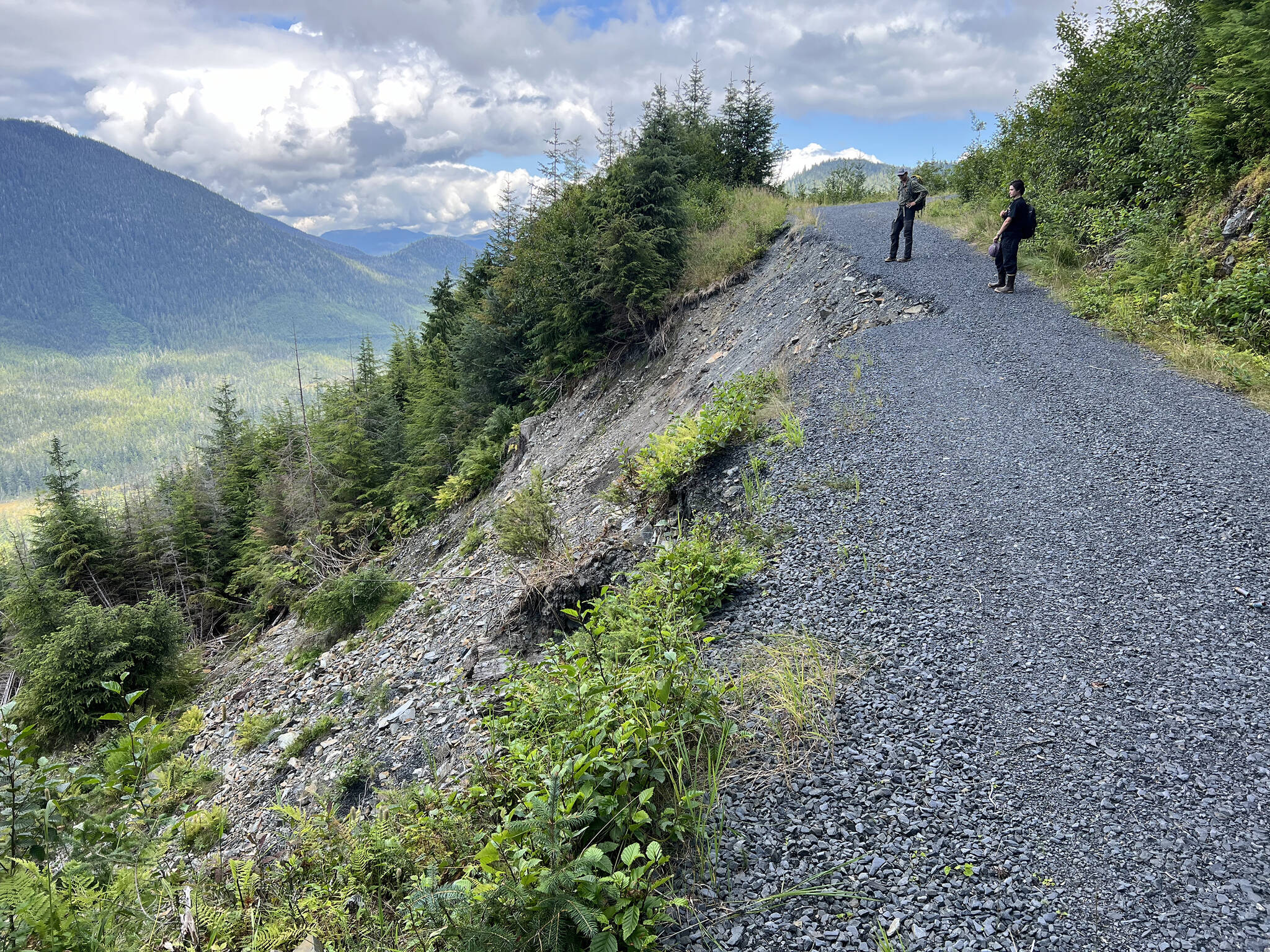
Hiking a landslide sight. (Photo by Annette Patton)
With support from the National Science Foundation, landslide research and hazard mitigation has continued and expanded from the Sitka landslide research team into the regionwide Ḵutí project. Ḵutí (Lingít for weather) aims to address community concerns about geohazard safety across the region. In partnership with tribal governments in six additional Southeast communities, this collaborative team is developing natural hazard alert systems and other risk reduction tools specific to each community.
Community-specific concerns include rockfalls in Skagway, slides and erosion in Klukwan, slides and road system viability in Hoonah, coastal erosion impeding access in Yakutat, slides across road systems in Kasaan, and slides threatening homes in Craig. With Ḵutí’s expansion, scientists are working hand-in-hand with community leaders and Indigenous knowledge bearers in Kasaan, Craig, Hoonah, Klukwan, Skagway, and most recently Yakutat.
Community involvement is key in producing both deeper understanding of geohazards and more inclusive and useful outcomes. Ḵutí is following the co-production of knowledge framework, originally developed in Arctic Alaska by Indigenous experts, to intertwine Indigenous knowledge systems with Western science to co-produce locally tailored research and solutions. Using the co-production of knowledge framework, communities are able to take ownership and direct the research needed to answer their questions.
“Southeast Alaskans are interested in a whole community approach to landslide risk reduction, information dissemination, and landslide response,” said Ella Neumann, SSSC’s research data manager. “We are dedicated to connecting people to the information and resources they need because we understand firsthand that resilience is a community effort.”
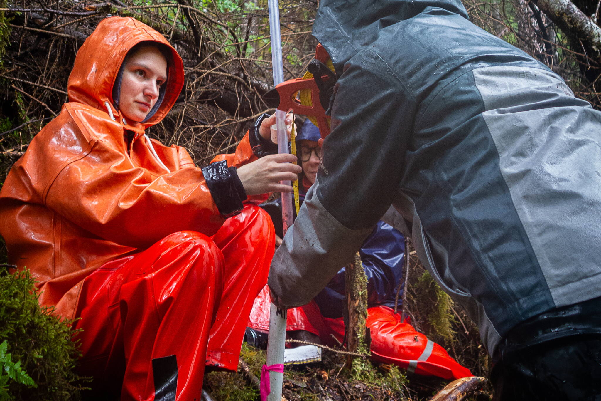
Hoonah Alaska Youth Stewards crew members plug sensors into WeatherChime environmental monitoring devices. (Photo by Zofia Danielson)
This exchange of knowledge happens in many settings from more formal community meetings to inclusive potlucks where community leaders share a meal with visiting scientists. All community members are involved including students through educational workshops and inclusive research opportunities where job skills can be developed and practiced.
The Ḵutí project is actively engaging not only diverse community perspectives, but also reaching across generations in Hoonah, and this year expanding to Craig and Kasaan. Zofia Danielson, SSSC research coordinator, and Sarah Tobey, SSSC science educator and community coordinator, partnered with the Alaskan Youth Stewards to install environmental monitoring equipment and to investigate landslides in Hoonah and Craig.
The Alaska Youth Stewards (AYS), a Central Council of the Tlingit and Haida Indian Tribes of Alaska program, uses an experiential learning approach to provide hands-on natural resource job training, community service, and cultural stewardship experiences driven by community-identified priorities.
In collaboration with Julian Narvaez and Bob Girt, the AYS program leads in Hoonah and Craig, our Ḵutí team met with the youth crew and got right to work. Joined by Chet Udell, professor at Oregon State University, and Adelaide Johnson, hydrologist, the AYS crews headed to the streams and the hillsides. In Hoonah, the crew installed four sensors along streams and one in a muskeg to monitor rainfall and streamflow. On Prince of Wales, the eight members of the AYS crew investigated the mechanics of landslides and measured the amount of groundwater in the soil on various hillslopes.
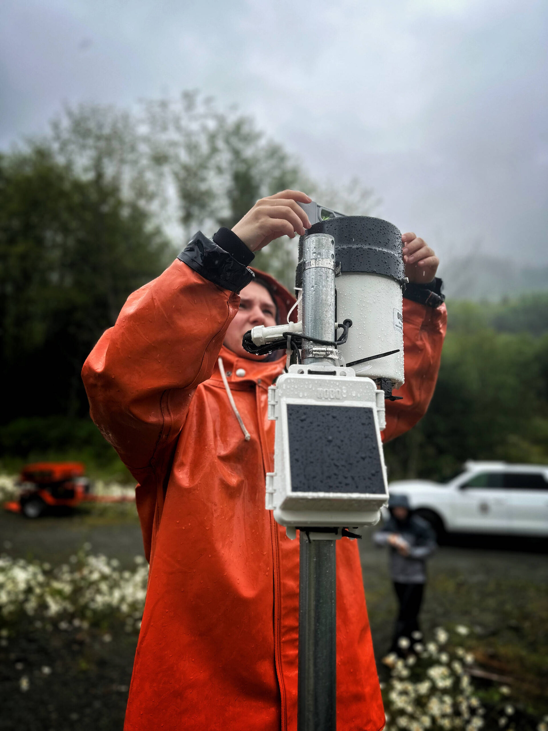
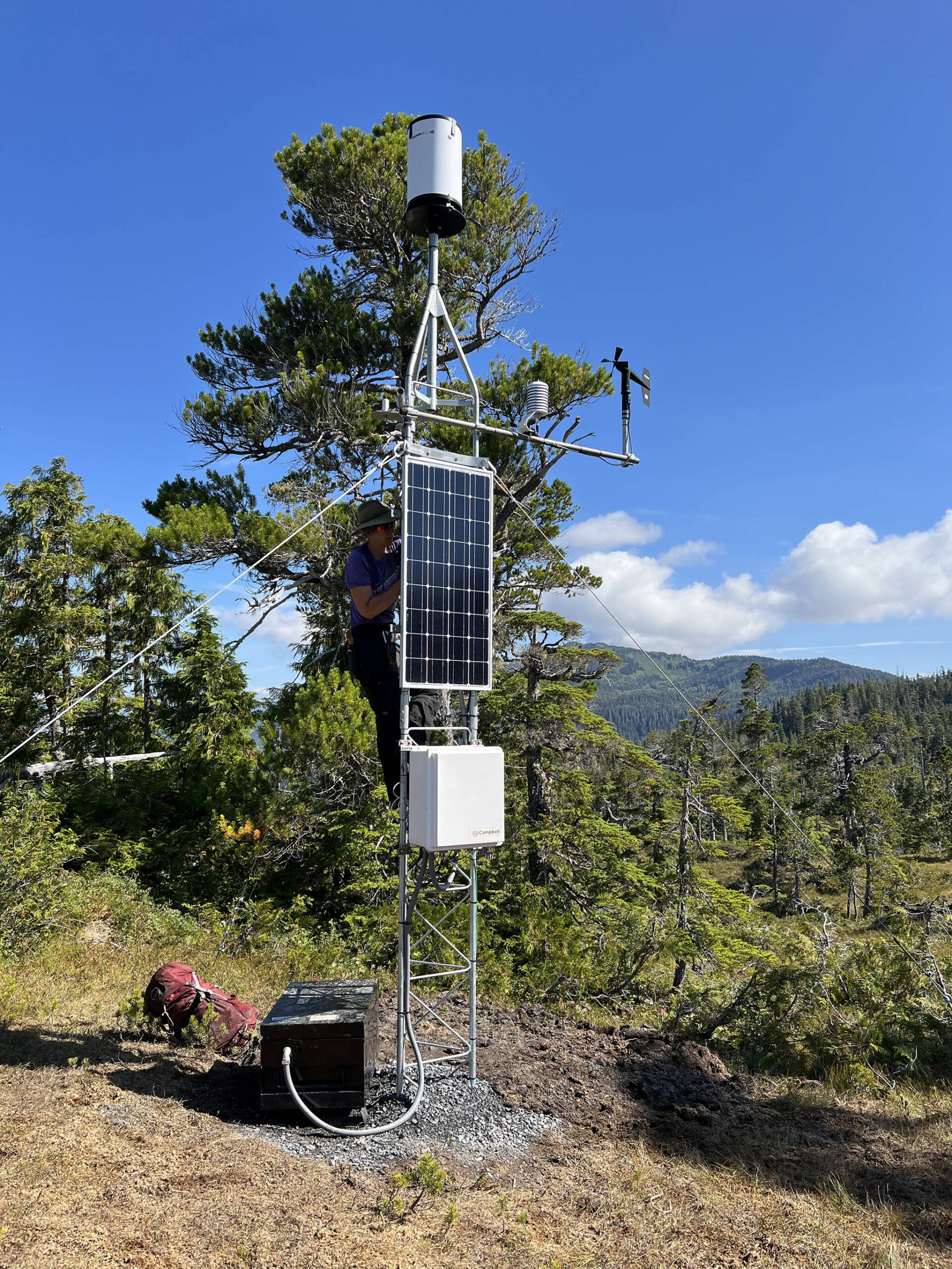
A Prince of Wales Alaska Youth Stewards crew member adjusts tipping bucket and rain gauge on Port Saint Nicholas Road. This device measures rainfall. (Photo by Zofia Danielson)
Both groups spent time reflecting on their community’s relationship to landslides and rainfall, sharing stories of geohazard impacts and the parts of this project that mean the most to them. The crew also practiced using data collected from the field to visualize how rainfall levels change with weather conditions. A highlight for the students throughout the trip was pulling on waders and practicing their river walking. Through installing sensors, taking measurements, and observing the impacts of geohazards up close, the Alaska Youth Stewards are well positioned as the next generation of leaders in their communities.
Environmental monitoring devices installed during the youth training are currently aiding in data collection for Craig and Kasaan. Both neighboring communities are in the beginning stages of their Ḵutí research with site visits and community-led workshops scheduled for early November. These initial activities will illuminate local concerns and specific geo-risks, which will allow Ḵutí partners to develop a plan that best address community needs. Each community is unique in both its people and land, because of this a one-size-fits-all model will not work, solutions to the growing occurrence of geohazards in the region must be specific to the people and place.
“It’s really important not just to work with people, but to compensate them as experts. You don’t have to have a PhD degree to be recognized as an expert,” said Sonia Ibarra, Tamamta co-program coordinator and postdoctoral fellow at the University of Alaska Fairbanks.
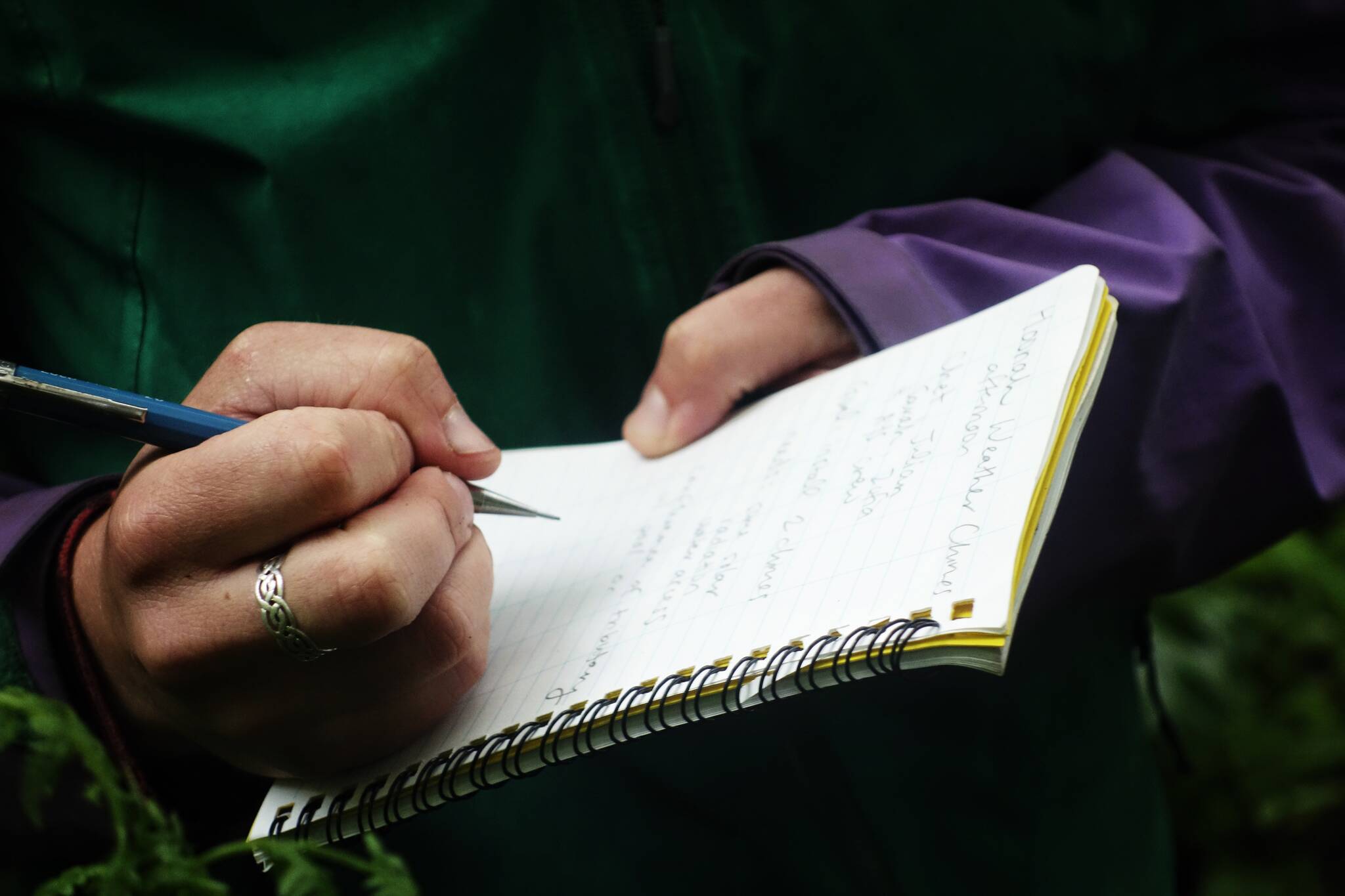
Annette Patton, lead geoscientist for Sitka Sound Science Center, takes field notes at a WeatherChime installation in Hoonah. (Photo by Zofia Danielson)
Ḵutí is still in its infancy but growing rapidly in response to the region’s pressing need. The more involved tribes and communities become, the more informed research will happen directing Indigenous community-centered solutions.
Even at this early stage, Ḵutí has stood out as one of the leading landslide risk-reduction groups within the United States. The USGS landslide preparedness act is developing a national landslide group, and representatives from the Ḵutí project have been invited to speak at their inaugural meeting in early November of 2024. Climate change has altered the planet dramatically forcing all to change and adapt. This shifting new world presents an opportunity to embrace a long-overdue transformation in how people can work together through co-production of knowledge to face challenges now and on the horizon.
To learn more about the Ḵutí project or get involved reach out to Luka Silva the incoming Kutí project manager, joining the group with a background in Socio-environmental work. Silva can be reached at lsilva@sitkascience.org or landslides@sitkascience.org.
The Kutí project is a partnership including the communities and Tribal representatives from Sitka, Yakutat, Klukwan, Craig, Skagway, Hoonah, and Kasaan; Central Council Tlingit Haida Indian Tribes of Alaska (Tlingit & Haida;) RAND Corporation; University of Oregon; Oregon State University; Scripps Institution of Oceanography; Sitka Tribe of Alaska (STA); USDA Forest Service; National Weather Service (NWS;) Alaska Division of Geology and Geophysical Services (DGGS); and U.S Geologic Survey (USGS). The project is funded by the National Science Foundation.

The receding Davidson Glacier on a flight to Haines. (Photo by Bethany Goodrich)
Resources
• Kuti Project: https://sitkascience.org/research-projects/khuti-southest-alaska-regional-landslide-research.
• Sitka Landslide Dashboard: https://sitkalandslide.org.
• Sitka Geo Task Force: https://sitkascience.org/research-projects/landslide-research/research/sitka-geotask-force.
• Alaska Youth Stewards: https://seacoastign.org/alaska-youth-stewards.
• A framework for co-production of knowledge in the context of Arctic research: https://ecologyandsociety.org/vol27/iss1/art34.
• Dr. Sonia Ibarra. “Sonia Ibarra — 2022 AISES Indigenous Excellence Awardee” YouTube, uploaded by AISES 2022: https://youtu.be/G-OpxhYMcTs?si=SC6JSsFSSllGl9CQ.
• Dr. Dave Petley. “Fatal landslides in 2024 to the end of September” The Landslide Blog, EOS Science News by AGU, Oct. 9, 2024: https://eos.org/thelandslideblog/september-2024-fatal-landslides.
• National Landslide Preparedness Act: https://www.usgs.gov/programs/landslide-hazards/science/national-landslide-preparedness-act.
• “Woven Peoples and Place” is the monthly column of the Sustainable Southeast Partnership (SSP). SSP is a dynamic collective impact network uniting diverse skills and perspectives to strengthen cultural, ecological, and economic resilience across Southeast Alaska. Follow along at sustainablesoutheast.net; on Linkedin, Instagram and Facebook at @sustainablesoutheast; and on YouTube @SustainableSoutheastAK.
A rain gauge. (Photo by Annette Patton)
